Local Forecast
Weather Wars: 7 Day Forecast Battle
Days Mon Tue Wed Thu Fri Sat Sun
Lee C. -- -- -- -- -- -- --
John Y. -- -- -- -- -- -- --
Temperature Verification
Days Mon Tue Wed Thu Fri Sat Sun
Temps -- -- -- -- -- -- --
|

Say Goodbye to fall

...Meteorological Fall that is...
Even though the official start of winter begins on the date of the winter solstice, (the 21st of December this year), meteorological winter begins tomorrow, December 1. Meteorological winter is defined by the National Oceanic and Atmospheric Administration as:

The onset of winter-like weather conditions, [and] occurs earlier as one moves northward

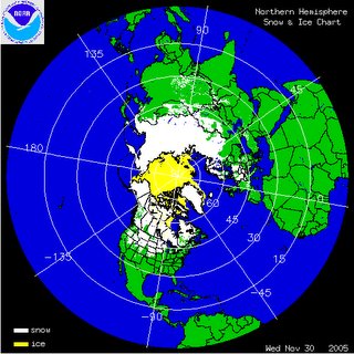
So on this last day of meteorological fall, we were treated to nearly average temperatures in the lower to mid 50s. And it seems fitting to introduce "winter" (although I will be re-introducing winter on the 21st) as snow cover is beginning to expand across the Upper Midwest and Rocky Mountain Regions.

Forecast the next 3 days:
The outlook for the next 72 hours remains relatively straight-forward as a weak high pressure cell off to our northwest weakens and slides eastward.

Tomorrow:
A weak low pressure system, aided primarily by upper level energy (aka: vorticity), is spreading light snow showers across a swath of the Midwest, from eastern Nebraska to Iowa. This system, which is moving at a fairly good clip from west to east, should approach the area tomorrow afternoon. Given the limited moisture associated with it, the most we'll see out of this low will be a few more mid-level clouds during the late morning/afternoon hours.

High temperatures will be a bit colder than today and will likely remain in the upper 40s.

Friday:
Winds Friday will be the main 'weather header' to close out the work week. The clipper-like low affecting the Midwest will begin to merge with a developing coastal low off the Northeast Coast during the day, and will likely usher in some breezy northwest winds of 10-20mph.

Temperatures, due to the wind direction/speed and what we call Cold Air Advection, will keep max temps in the mid 40s.

Saturday:
This will be one of those days when you should be inside, maybe next to a warm fire. An approaching low will spread clouds our way, and highs will be a bit on the nippy side as they struggle to touch 43-45. I don't expect any precipitation during the daytime hours of Saturday.

The forecaster's nightmare!
The developing weather pattern past Saturday has the potential to drive even the sane insane. There are so many variables coming together at a specific time, one wrong forecasting move weather features during this timeframe becomes disastrous.

We basically know a low pressure system will develop in the southern part of the US over the weekend and progress eastward towards Georgia and Alabama by Sunday. The problems arise when asking "will we see snow or not," and "when will the precip start?" Both of these questions go in tandem with one another, because if precip begins to fall in the Mid Atlantic late Saturday night, after radiational cooling has allowed surface temps to fall below freezing, precipitation would begin as snow, or possibly a freezing rain/sleet mixture.

The GFS model has been having a fascinatingly horrid time at forecasting this low pressure feature. For that reason, I am still not putting a lot of weight onto this numerical model. At this point, I think precipitation will break out across the metro region between midnight and 5AM as snow, but a changeover to a rain/snow mix will occur during Sunday.

Again, I will use a phrase that seems to be used too many times: this is not written in stone, and a considerable amount of uncertainty still exists regarding Sunday's storm system. If this were to remain all snow (and at this point, the chances are about 3:1 it doesn't) then we could see snowfall accumulations around 1-4 inches. But again, I don't really see support from models that would uphold this event remaining all snow.

Ice Age!
I do not know how reputable this site is, but New Scientist.com has released an article describing how the ocean current (part of the global Thermohaline Circulation pictured at right) that delivers Europe's "relatively balmy climate," is shutting down, and introduce Europe to a "mini-ice age."

Scientists attribute this shut down of the current to global warming, although there is some doubt to that speculation.
By Lee Carlaw On Wednesday, November 30, 2005 At 7:48 PM
|

Confused Computer Models

After another one of those dismal, dreary, despondent days of late autumn, things will once again brighten up as a large frontal boundary thunders through the region later tonight. Showers and thunderstorms, for the most part, have been of the "hit-or-miss" variety after being chewed up by the Appalachians. Areas north and west of the city have reported rainfall totals near 1 to 1.5 inches since the onset of precipitation earlier today. Some locations in the higher elevations out west (Augusta and Nelson Counties in western VA) have reported rainfall totals near 5-7". At this point, only .04 inches have been collected in the rain bucket in southern DC.

Showers and embedded thunderstorms continue to consolidate and intensify as a cold front nears the area. You will need to keep the umbrella handy if you plan to venture outdoors later this evening.

What we have here are some confused weather Models:
With all the chatter of the potential for some wintry-type precip invading the region next week, I thought this would be a good time for me to clear a few things up. First, the GFS, which is probably the most commonly employed computer model for mid-term forecast guidance, continues to have severe run to run continuity problems reflected in its forecasts between 1130 and 150 hours out. The image at right (clickable to see larger image) is a mosaic of three separate runs of the GFS, all valid at the same time-Monday November 5th at 18z (1PM EST). The run on the far left is from 00z (last night) 06z (late last night), and 12z (this morning). Notice the position of the low pressure system during Monday afternoon--the low shifts its position by 200-400 miles between computer model runs!

Keeping it short and sweet: the GFS is having a very difficult time with the upcoming weather pattern. It has been having incredibly "mood swings" if you will, and until this model can get its act together, it is probably wise to follow the more consistent European and Canadian Models.

Now onto the more pressing matter of: Will I get snow?

At this point, there appear to be two separate storm systems that will effect the region next week. The first is what we call an "overrunning event" as a "zipper low" develops along a stalled out frontal boundary to the south of DC during the day Sunday. At this point, temperatures during the event appear very marginal to support snow showers, and precip should fall predominantly as a cold rain. However, there is the potential (albeit quite small) for areas north of DC to squeeze out a few flakes from this system.

The next system to effect the region follows quickly on the heels of this overrunning system Monday evening/Tuesday. This may end up turning into a sizeable event, although precip type becomes a major problem as this event is nearly 6 days out. The image above is the European Model forecast Tuesday morning of the surface pressure (white lines) and temperatures about 2,000 feet up (shaded colors-greenish yellow is approximate freezing line). This type of set-up would favor a significant snow event for the metro region Monday night and Tuesday morning given the presence of a coastal low and favorable low level temperatures.

Still, this event is lightyears away, and I can recall many a time when the European Model busted what appeared to be a perfectly viable forecast (not saying the one depicted above is a perfectly viable forecast). This is just something to watch. We have over 120 hours separating us from these events, and plenty of time to pin down developing features and forecast details.

Stay Tuned!

By Lee Carlaw On Tuesday, November 29, 2005 At 3:28 PM
|

Dismal Tuesday Afternoon

Well, I guess that 100% probability of precip call was a bit optimistic. A lot of the pre-frontal precip has been chewed up by the moderately high peaks of the Appalachians, and what's more, the front appears to be progressing slightly slower than I had anticipated. Nonetheless, I still expect rainfall to pick up in intensity and coverage through the day. Showers and scattered thunderstorms should become numerous by the evenings rush hour.

With that said, it will be a bit breezy today as the cold front makes its approach on the region, and be sure to dust that umbrella off if you plan to head out later this afternoon. As for high temperatures, computer model guidance appears way off this morning, as most short range models indicating high temps today in the mid 60s. As is normally the case with approaching frontal boundaries, numerical models have a tough time predicting temperature trends. Washington currently reports a temp of 65 (which was the forecast high from the AVN model).

Expect highs today to range from the mid 60s north and west of the city, and near 70 closer to the immediate metro region.

Epsilon in November:
I don't know about the rest of you, but talking about the 26th named storm of the Tropical Atlantic Hurricane Season just doesn't seem right. At 11AM AST (that's 10AM here), Tropical Storm Epsilon formed over the central Atlantic Ocean. This should just be a nuisance storm for mariners between Bermuda and the Azores.
By Lee Carlaw On At 10:30 AM
|

Blizzards, Tornadoes, and Torrential Rain

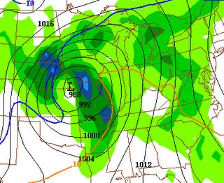
That's the story today throughout the eastern half of the Continental United States. A very potent surface low is located in southern Minnesota, with minimum pressures approaching 980mb, and is creating a multi-faceted weather scenario stretching across nearly 1000 miles of land, from the upper Midwest, southeastward into the northern Gulf of Mexico.

Blizzard warnings remain in effect for areas on the northwestern side of this low-and snow drifts in central Nebraska and South Dakota will likely range from 2-4 feet before all is said and done. And less than 500 miles away, tornadoes and severe thunderstorms tore apart homes yesterday during a significant severe weather outbreak across the ARKLATEX region (Arkansas, Louisiana, Texas). Nearly 30 tornadoes were reported across the said regions, and as the Washington Post reports, mother nature didn't go peacefully-as one motorist was killed in the Capital city of Arkansas.

Weather Round-up:

Tuesday: By tomorrow morning, precipitation chances will once again ramp upwards rapidly in response to an approaching cold front associated with the aforementioned low pressure in the Midwest. There is a good chance small chance some thunderstorms bubble up during the afternoon. Hefty rainfall totals approaching 1 inch should be commonplace as the cold front roars through our region during the evening.

Probability of Precip: 100% by 9AM
High Temp: Mid 60s

Wednesday: Rain and clouds zip out of the region by mid morning, but temperatures will respond to an approaching Canadian High pressure cell.

High Temp: Mid 50s

Thursday
: For the most part, Thursday should remain mostly sunny and dry. A very weak clipper system is expected to develop around the Great Lakes region and hitch up with a stalled low just off the New England Coastline. This system may throw some more cloudiness our way, but at this point, I don't see any precip making it into our region.

High Temp: 46-50

Wintry Weather Outlook:


Precip-Type: Rain/Snow
When: Dec. 4-5

So, we're approaching December and we should have something to look foreword to (besides Christmas).

By the end of this weekend, and weak low is expected to race eastward from the nation's midsection into the Mid Atlantic. At this point, surface temps in the metro region appear too warm to support anything more than a chilly rain. However, some computer models are bringing in the rain/snow line very close to the major cities Sunday evening.
By Lee Carlaw On Monday, November 28, 2005 At 4:54 PM
|

Rainy Start to the week

After chilling thoroughly in the freezer for 2 days, we are being pulled out to enjoy some milder, spring-like temperatures, albeit at somewhat of a price. An energetic storm system continues to develop in the Midwest, spawning some significant severe weather across the ARKLATEX region, a blizzard in the upper Midwest, and rain showers closer to home. (I wasn't kidding when I said an "energetic storm system").

Outlook the next few days:
The showers (occasionally moderate) around the Mid Atlantic are being spawned by some week vertical motion, coupled with Warm Air Advection from the south as a High pressure cell to the northeast lifts out towards the Canadian maritimes. I anticipate many of these showers will have progressed north and east of the region by tomorrow morning as a warm front attempts to break through areas downwind of the Appalachian Mountains.

A forecast challenge develops tomorrow afternoon with respect to high temperatures. It appears the previously mentioned warm front will attempt to break through our parallel tomorrow afternoon, but will likely encounter strong opposition from low level "cold air" leftover from weak Cold Air Damming. Cold air is much "heavier" than warm air, and warm air has a difficult time displacing colder temperatures. For this reason, I don't expect high temperatures to get much higher than say 60-62 degrees around the immediate metro region.

Probability of Precip: 25%
High temp: 61 at National Airport

By Tuesday, a cold front is once again knocking on our doorstep. Rain showers and possibly a few thunderstorms will once again work there way into the forecast. A significant rainfall event appears possible Tuesday as the cold front begins to press its way into the metro region. The image at right (morning run of the NAM's precipitation totals) suggests a widespread .75-1.5" rainfall event before the frontal passage occurs late Tuesday night.

Probability of Precip: 95%
High temp: 62 at National Airport

Wednesday will feature improving weather conditions as weak high pressure noses on into the region from the west. Expect generally clear conditions through the end of the week.

Probability of Precip: 30% in the morning, decreasing to 0% by afternoon
High temp: 54 at National Airport

Extended Outlook
More storms and colder temps on the horizon?

As we continue to work our way towards the Christmas season (and for some, I guess it already is the "Christmas Season") and the official start of Winter, there are some good signs that Old Man Winter will begin his fight back. The NAO, famous for being to dominant mode of winter climate variability in the Eastern US, is forecast to rise sharply over the next week or so (bad for cold weather), and then dip down towards negative during the middle of December (good for cold/winter weather).


Subsequently, the Pacific North Atlantic (PNA) oscillation is forecast to ramp up towards a highly positive phase (good for cold weather in the east) towards the early/mid parts of December. The image at right are ensemble model forecasts for the PNA index--the red lines are the various ensemble member forecasts for the index. Again, above the zero line is usually a good indicator of a trough in the Eastern United States (cold weather).


**** **** *** ****

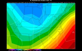
Furthermore, the latest runs of the Mid-range star child model, the ECMWF, continues to indicate the possibility that a large Polar Vortex (area of very low atmospheric heights, hence, very low surface temperatures) envelopes Eastern Canada, northwest of the Gulf of Saint Lawrence by December 7.

The image to the left is the DAY 10 ECMWF forecast at 500 mb (15k-20k feet up) valid December 7. While I don't necessarily agree with this models interpretation of the general pattern in early December, the aforemnetioned indices--PNA, NAO--would both favor a pattern similar to something like this.

I guess this is what I'm trying to say: colder air looks like it will begin an invasion of the Continental United States once again in the next few weeks. If we can get some Canadian Energy to dive down and generate a nice little low along the east coast, we'll be in business.

Snow lovers just need to wait a few more weeks--WINTER IS JUST AROUND THE CORNER.

Image Credits:
(1) NAM Forecast precip from NCEP
(2) PNA index forecast courtesy of the CPC
(3) ECMWF 10-day forecast courtesy of Plymouth State weather

By Lee Carlaw On Sunday, November 27, 2005 At 5:20 PM
|

Black Friday: Welcome to January

Bone Jarring Cold:
While walking around your house today, be prepared for some shocks while going to open the closet door. Whatever you do, don't go around scuffing up those old shoes on your rugs today...you'll be in for an "electrical" surprise.

Needless to say, dewpoint (and Relative Humidity) values today are the lowest they have been in a long time. Because Relative Humidity (RH from now on) is the measure of how close the air is to saturation, and the Dewpoint is the quantity of moisture in the air, many people get the two terms intertwined. The RH on a partly cloudy day of 70 degrees can be 80 percent, and the air will still feel comfortable. Now take a 60 degree dewpoint and tack it onto that 70 degree day and you've got yourself a good old fashioned sweat-fest.

With that bit of weather information under your belt, the RH outside can be around 30-40 percent on a day when the air temperature is over 100 degrees, and the dewpoint is near 70. With this set-up, the air feels heavy and very muggy, even though humidity values are comparably low.

In today's case, RH values are near 30 percent, and dewpoint values have tumbled from the 30s to below zero in a matter of 12 hours, all thanks to the passage of a ridiculousy powerful arctic cold front.

Today's Outlook:
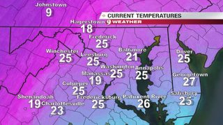
For those of you heading out on this Black Friday for some shopping should be weary of the very cold temperatures. Lows this morning ranged from the mid teens out west, to the lower 20s closer to DC. With winds still gusting to near 15-20 mph, wind chill values (what the air feel like to the skin) are in the single digits and low teens. Be sure to bundle up with extra layers to combat these January like temperatures.

High temperatures today will not make it into the 40s.

Image above right: Temperatures at 900 hour courtesy of WUSA9 Weather

Dwindiling Delta:
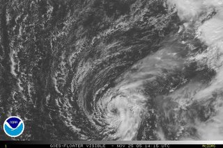
For those of you that didn't know, Tropical storm Delta developed this past Wednesday in the far reaches of the eastern Atlantic Ocean. It seems to upper level shear will once again claim the life of another tropical cyclone in the next 24-48 hours.

Still, maximum sustained winds are around 65 mph, but is of no concern to the Continental US. After Delta becomes extratropical, the wind field should begin to expand as it veers back towards the northwestern African Coastline.

No other tropical development appears imminent at this time.

Image: Visible satellite shot of TS Delta in the eastern Atlantic. Courtesy of the NHC.
By Lee Carlaw On Friday, November 25, 2005 At 9:16 AM
|

From snow to above average Temperatures

Some hints of thanksgiving linger here as turkey leftovers and mashed potatoes still sit in the fridge, while a little more than just a hint of January cold has set in across the region outside.

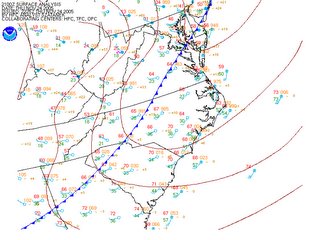
A few hours ago a very intense arctic front crossed the Mid Atlantic, and continues to progress eastward towards lower southern Maryland and the Southeast Coast.

Winds have ramped up significantly around the area, with most observation stations reporting wind gusts in the 30mph range, and as air temperatures drop off into the upper teens and lower 20s, wind chills will approach there coldest values of the season later tonight.

If you plan to venture out later this evening, plan on wearing a couple heavy layers and make sure to button up. By morning tomorrow, surface winds will have slackened somewhat as a weak overnight inversion sets up (increase in air temperature with height until about 1kft above the ground, as opposed to the normal decrease with height), but should not inhibit overnight wind chills to plummet into the single digits out west, and mid teens closer to home.

Don't fret, a Warm-up is Near:
I'm sure this title will get the snow lovers writhing in pain, but we have to remember, it still isn't winter. It seems that we snow fanatics get more spoiled every year, hoping for snow on earlier and earlier occasions; and the snowfall last night either got you salivating for more, or praying for a 70 degree stretch of weather. By this Sunday, the trough in the East will have eroded, handing the stage over to a developing ridge (kind of a high pressure system in the upper levels of the atmosphere), which should begin funneling much warmer temperatures into the region.

High temperatures through the middle of next week will return to "normal" levels (and then some) topping out in the upper 50s and mid 60s. I am tempted to say temperatures may rocket towards 70 early in the week, but a developing low in the Midwest might hamper these prospects somewhat.

This surface cyclone (which could turn into a good sized winter storm for the Upper Midwest) will throw clouds and showers in our direction late Monday and into Tuesday.

At this point in time, it appears that by Tuesday afternoon, we have popped into the warm sector, south of a progressive warm front, and this should beef temperatures into the low-mid 60s. Depending on the amount of instability that can develop through solar radiation (breaks in the cloud deck) we may have a shot at some thunderstorms Tuesday afternoon and evening, before another cold front whips through the area.

Image (1): HPC Surface analysis earlier this evening showing a powerful cold front racing through the region

Image (2): GFS model prog valid late early Monday morning with a deepening low in the Midwest. Courtesy of NCEP.
By Lee Carlaw On Thursday, November 24, 2005 At 5:58 PM
|

A Happy Thanksgiving from DCweather

Thanksgiving Clipper to Remember:
So, we expected a Clipper and got a Clipper...and then some. Precipitation broke out across the metro region around 6PM, beginning as very light snow flurries. By 9PM, dry surface air had eroded, and moderate snow began tumbling into the city and surrounding region. By 930, snow accumulation reports began filtering into the Warning Forecast Office at Sterling, Virginia, with meteorologists there recording about 0.4" of snow.

Currently, we have zip snow accumulation on the roadways and concrete surfaces (which have a lower albedo and, hence, absorb more incoming radiation than wood or grass) while about 0.4" of the white stuff has accumulated on my outside table and snow board.

Clipper systems like this are notoriously fast movers, and snowfall usually doesn't last for more than 3-6 hours or so, and this is no exception. Scattered snow showers will linger through the night, after this main large batch of precip scoots east of the city. I still do not expect any snowfall accumulations on the concrete/road surfaces in the general metro region, although as current reports dictate, totals of 1 inch are not out of the question on grassy surfaces.

Major Arctic Blast:
As Clipper's often do, a large and severe swath of arctic air will plunge southward tonight and tomorrow, dropping high temperatures into the low teens in the upper Midwest, and lower 40s closer to home. By Friday, highs have dipped even further into the upper 30s. Lows Thursday and Friday night will dip into the upper teens and lower 20s across the entire region, and wind chills Thursday evening will likely drop off into the lower teens in the metro, and single digits further west.

Jet stream next week. Image from
NCEP/NWS
This cold surge is, however, short lived as the graphic to the right summarizes nicely. Next week, the upper level ribbon of quickly moving air that is the jet stream surges northward into southeastern Canada as a Pacific Jet deepens in the Pacific Northwest, and a trough carves out in the Midwest.

So, expect generally mild temperatures next week (possibly breaking through the 60s next Monday). There is also the potential for some showers and even Thunderstorms during the Monday afternoon and evening timeframe as a cold front approaches the region from the west.
By Lee Carlaw On Wednesday, November 23, 2005 At 10:30 PM
|

Weather Cooperates for Pre-Thanksgiving Travelers

For those of you heading out of the region today, the weather will cooperate with mostly sunny to partly cloudy conditions. A weak clipper system is forecast to skirt the US/Canada boarder later tonight-bringing the first chance for some snow showers to the region for the Thanksgiving Holiday.

DCweather.com Travel Cast:

Today:
The only impeding aspect to holiday travel this afternoon will be the winds. Gusts to 30 mph are occurring across the entire region at this time, and those of you traveling in high profile vehicles should use a little extra caution on the highways today.

Tonight: For those of you hitting the roads later this evening, you could be in for a little taste of winter. Heading north in Pennsylvania along the I-95 corridor will be smooth sailing until about midnight. By that time, a developing Alberta Clipper should be located back in the upper peninsula of Michigan, and will likely be spreading **light** snow showers across central Maryland, and parts of PA. Please use caution on the roads tonight, as even light snow showers on warm ground can make travel hazardous.

If you're traveling southbound on the Interstate, still be on the lookout for some light snow showers/rain showers late tonight.

Thanksgiving Day: By sunrise, most of the flurries/snow showers will have exited the immediate metro region, but folks traveling in Pennsylvania, or into the Appalachian mountains should expect hefty snow showers, possibly accumulating to 2-4 inches.

Metro region Outlook:
I'm sure the event on all of your minds is the impending clipper encroaching the region from the northwest. The image at right reveals snow showers already breaking out across portions of Michigan and the Ohio River Valley, all in association with the developing Clipper system.

Tonight, very weak forcing (known as UVV or OMEGA in weather-speak) moves into the region around 12AM-5AM tomorrow morning. The amount of OMEGA present at that time looks to be somewhere arond 5-10 microbars/sec, not a very large amount. However, there is a relatively good chance we see some light snow showers late tonight, but don't expect any accumulation on the road surfaces--maybe a little dusting on the grass.

And I think this is a good time for me to announce that I am snow-lover, and there might be some very small hints of "wishcasting" in this forecast. I have attempted to base this forecast solely on model trends, current analysis, etc., with as little outside thought intervention as possible.

Above Image courtesy of WUSA 9 Weather

Extended Outlook:
Not much to talk about at this point in the extended. High temperatures plummet into the 30s Friday and Saturday as the Alberta Clipper deals us another reinforcing shot of Arctic Air. By the end of November, some Numerical Models are pointing towards a short warm up, as an upper level ridge breaks down in the north central Atlantic (our -NAO).

It is too early to pinpoint details in this forecast, but I expect a general warming trend to commence after this weekend-and high temperatures should be able to poke their way into the mid 50s (maybe 60s?) by next week.

But snow-lovers don't fret. After November comes to a close, the potential for more Canadian Air invasions will once again come to life, along with the progression into a, dare I say, stormier pattern.
By Lee Carlaw On At 12:06 PM
|

Nor'Easter Mayhem

A powerful late November Nor'easter roared to life today along the Eastern Seaboard, battering coastal sections of the Mid Atlantic with 30+ mph winds, heavy rainfall, and snow showers farther inland across interior sections of Pennsylvania and New York. And just as a little food for thought, if this scenario had taken place in the heart of winter, we'd most likely be rejoicing (or repulsing) at the site of a winter wonder land consisting of hills of snow measuring 3 feet deep in some locations.

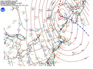
Currently, an incredibly intense low pressure system is bombing (intensifying rapidly) in extreme northern Maine, wrapping gusty northwesterly breezes into the Northeast and piling anywhere from 1-9 inches of snow in the mountainous regions of upstate NY, Vermont and New Hampshire.

Surface Analysis courtesy of NCEP/HPC/NWS

Outlook:
By tomorrow morning, winds will have subsided into the 5-15 mph range as the low pressure system continues its track towards the northeast. A mini surface high/ridge builds into the region during the afternoon Wednesday, however, even under partly cloudy skies, temperatures will fail to make it into the upper 40s, and will more than likely be confined to the lower end of the 40s, and it wouldn't surprise me to see some upper 30 degree readings in northern MD.

Clipper-thoughts For Turkey Day:
There is chatter going around that a clipper will make its way into the region Wednesday night-and possibly lay down a coating of the white stuff for Thanksgiving. However, surface temperatures look far too warm to support any snowfall accumulation in the metro region (save the sheltered grassy areas). Folks living out in Western MD and the Appalachian mountains may see snowfall accumulations approaching 3 inches.

As is often the case with clippers, they are not connected to any large moisture source, and come through the region bearing little in the way of gifts for the Mid Atlantic, and this is no exception. The Appalachian Mountains should provide a large obstacle for the snow showers to maneuver around, and a majority of the precipitation will be confined to the western slopes of the Mountains.

Still, late Wednesday night we can expect a 40-60 percent chance of a few light snow flurries/showers across the immediate metro region, but with little in the way of accumulation.

Longer Range:

As this clipper low pulls away Thursday afternoon, colder air will once again be drawn southward into the region, and high temperatures should plummet back into the 30s by this weekend.

Tropical Weather:
The NHC is still closely monitoring an area of thunderstorms about 1000 miles southwest of the Azores way out in the eastern Atlantic. If this system develops into a Tropical Storm its name would be DELTA. Here is a snippet from their daily Tropical Weather Outlook:
A STRONG AND LARGE NON-TROPICAL LOW PRESSURE SYSTEM OVER THE CENTRAL ATLANTIC CENTERED ABOUT 1000 MILES SOUTHWEST OF THE AZORES ISLANDS IS DRIFTING SOUTHWARD. THIS SYSTEM IS GRADUALLY ACQUIRING TROPICAL CHARACTERISTICS AND COULD BECOME A TROPICAL STORM AT ANY TIME.
By Lee Carlaw On Tuesday, November 22, 2005 At 8:49 PM
|

The Week Ahead- A Major east coast storm Brewing

Currently, clouds and showers continue to expand northward in association with a developing coastal storm, (that will likely become a major Nor'easter tomorrow) with the remnants of former Tropical Storm Gamma. Light to moderate showers have already overtaken areas just south of the District, and will likely invade the immediate metro region in the next few hours.

Outlook:
Today will feature thick overcast clouds, cooler temperatures, and a good chance for rain showers. By late this afternoon, rain will have overtaken the entire Mid Atlantic as a developing low pressure system intensifies along the Delmarva Coastline. High temperatures should remain in the lower 50s.

By Tuesday morning, the low should be located along the Northeast coast, and northwest winds will begin wrapping cooler air into the area. Winds Tuesday afternoon will be gusting to 30 kts (35-40mph) along the coast, and near 15-25 mph further inland. POPs (Probability of Precipitation) will decrease rapidly as the day progresses as the coastal low wraps up and moves into the Canadian Maritimes.

High temperatures will struggle to make it out of the 40s across the entire region.

Hydrology: While precipitation totals will likely range from 1-3 inches, there are low flooding concerns given the relatively dry ground, and high flash flood guidance amounts. Still, any heavy downpours have the potential to cause ponding of the water in low lying areas.

*********

We clear out Wednesday as a mini-ridge skirts the southern portions of our region. Temperatures Wednesday will likely be in the upper 30s in the northern 'burbs, and closer to 40 in the metro. By late Wednesday evening, a good-sized clipper system is expected to dive southeastward out of southern Canada, and overspread snow showers in the Appalachians.

Around midnight Thursday morning, rain/snow showers are forecast to overspread the metro region--and yes, temperatures at least Wednesday night look to favor some form of frozen precip, which is snow at this point. There is still uncertainty regarding the progression of an upper level trough that would swing through the area Wednesday afternoon...the faster it progresses east, the less cold air will be available in the Mid Atlantic.

Still, I have moderate confidence in this forecast that rain and snow showers will enter the region Wednesday night and during Thanksgiving Day. Temperatures Thursday afternoon would not be as favorable for snow aggregation in the lower levels--and precipitation would likely turn over to rain showers with what solar radiation gets through the thick cloud deck.

Through the rest of the month, temperatures will remain well below average as they hover in the upper 30s and lower 40s.

Above Image: Courtesy of Accuweather.com

By Lee Carlaw On Monday, November 21, 2005 At 10:03 AM
|

Beautiful Close to a Beautiful Weekend

What a weekend this has been! Loads of sunshine will once again dominate the forecast as temperatures climb into the mid and upper 50s across the metro region. This will be one of the nicer days in the coming week as high pressure decides to bid farewell to the region tomorrow afternoon.

Outlook:
Tomorrow, the surface high that has been sitting on top of the metro for the past few days rapidly deteriorates as a low pressure system (with the remnants of former Tropical Storm Gamma) begins to develop along the southeast coast. Clouds will thicken rapidly over the course of the afternoon/early evening as the strengthening low approaches. Precipitation chances increase to near 90 percent by nightfall Monday.

Tuesday will feature coastal gales approaching 20-30 kts (25-35 mph) and hefty rainfall totals approaching 1-3 inches across the entire region. Even though Tuesday looks to be a washout, the coastal storm is embedded in a quick upper level flow that will zip it on out of here by Wednesday--granted--a few showers will likely remain around the region during the morning hours.

As a result of this coastal low, very cold Canadian air will once again invade the east coast Wednesday and linger through the Thanksgiving weekend.

Snowy Thanksgiving...
Now here's a useful equation for you snow fanatics out there:

Cold air + Clipper=Snow

A trailing clipper system (a quite sizeable one at that per the latest GFS model-but likely overdone) behind this departing cyclone is forecast to move into the Mid Atlantic late Wednesday night/Thanksgiving day. Surface temperatures at this point, appear to be at least marginally favorable for some rain/snow showers even in the immediate Metro region. Don't expect any accumulation though, as surface temperatures will be quite "mild" in the upper 30s to near 40.

Redskins vs. Raiders


Game Time: 1PM ET
At kickoff time, expect temperatures to be hovering in the low-mid 50s with calm winds. Make sure to wear a jacket as temperatures will dip to around 50 by the end of the 4th Quarter
By Lee Carlaw On Sunday, November 20, 2005 At 11:52 AM
|

It's Freezing out there!

Beating the Cold:
This is yet another perfect example of the extreme variability of the weather--our high temperatures plummeted from the mid 70s into the lower 40s in about 48 hours, with biting winds chills in the mid 20s. Even the full force of the sun won't be enough to coax temperatures above 50 degrees.

Tonight, with winds calming even further, and clear skies prevailing across the entire Mid Atlantic, I wouldn't be surprised to see some lows in the upper teens in northern MD, and even some lower 20s closer to the district. Although, the proclaimed Urban Heat Island effect will more than likely keep the immediate metro area "toasty" in the mid 20s.

Tomorrow mornings attire will consist of a heavy jacket, and heavy layers of clothing to beat the cold chill.

Image right courtesy of the EPA: Schematic of the "Urban Heat Island" as temperatures rise in and around urbanized regions

While Sunday and Monday will be cold, they won't be quite as nippy as today and tomorrow. High temperatures will likely make it into the mid-upper 50s both days.

Coastal Low..Winter-like scene next week?
While a coastal low does look to develop come Thanksgiving time, cold air really isn't entrenched in the region to allow a full snow event. Keep in mind that this is mid November, and any snowfall accumulation this early in the year is absurd, especially east of the mountains. Nonetheless, this is an event to watch given the fact it is occurring so early in the "winter season." If this event were to occur a month or two later-the large scale synoptics would favor a large snowstorm for the Mid Atlantic.

A large +PNA (Pacific North American) ridge extends across the Western coast, and a monstrous -NAO is developing as a Greenland high pressure system forces successive troughs to deepen and move southeast into the continental United States.

But, in reality, it is not December and temperatures do not look to be favorable for snow accumulation. If a coastal low does indeed develop in its forecast position--about 100 miles off shore, we could be in for a good rain producer...possibly mixed with some wintery precip in the metro area as the storm winds down and draws in cooler air.
By Lee Carlaw On Friday, November 18, 2005 At 9:54 AM
|

Jack Frost is Here

After an early morning low of 37 degrees, the temperatures today couldn't muster enough energy to eclipse the 45 degree mark set overnight. At 1201 AM last night, Reagan National Airport recorded the highest temperature valid for Thursday, November 17th of 45 degrees. Temperatures during the afternoon today never made it above 42 degrees, and have already fallen off into the upper 30s as of 6PM.

Outlook:
Without a doubt, this will be the coldest night of the season as cold, Canadian high pressure slides over the area. Winds will slacken overnight, and allow temperatures to plummet into the 20s across most of the region. Areas of western Maryland will likely fall to around 20 degrees under mainly clear skies.

And for those of you who love the warm weather, you may have to move down south a ways for the next couple weeks as highs meander in the upper 40s/near 50. A persistent upper level trough and associated southward bend in the jetstream will remain situated over the region for the next couple weeks at least.

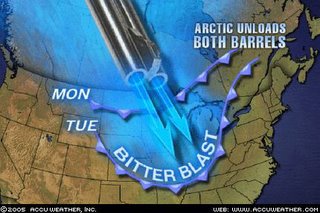
Over the past several months-as alluded to in previous posts-Northwestern Canada has been stocking up massive amounts of cold air, and there are some temperature readings below -20F around Victoria Island and the Beaufort Sea in extreme northwestern Canada. This graphic provided by Accuweather pretty accurately sums up what is occurring-with interest spent on what happens next week to temperatures.

One strong cold front rolled through here yesterday, dropping our temperatures by a good 15-25 degrees. However, the bitter cold is already regrouping in the Arctic, readying for another massive invasion into the Continental United States next week. There is uncertainty as to how "massive" this new wave of cold air is, but early indications are that high temperatures may have a hard time even getting out of the low-mid 40s next Wednesday/Thursday.

Going by the GFS models interpretation of the weather data, highs next week would be sitting in the 30s. This is however, based off of the afternoon 18z run of the model, which occurrs in between the 12z and 00z launch of weather balloons to sample weather data. So, I generally try to steer clear of the 18z and 06z model forecasts when possible.

Some of the white stuff next week?
Early next week, a low pressure system (well offshore) moves northeast into the Grand Banks/Canadian Maritimes. In it's wake along the east coast is a weak surface low that will likely begin a track northeast towards eastern Canada by Thursday. The location of this system with respect to the east coast is uncertain, and will ultimately play a large role in if we get any precipitation at all.

Whatever the case is, this will not be a 3"+ snow event for the region, rather, a few flakes will be possible here and there, possibly mixed with some cold rain. Chances of any precip are small at this point, given model uncertainty and the extended timeframe.
By Lee Carlaw On Thursday, November 17, 2005 At 5:56 PM
|

Rude Awakening to December-Like Weather

*COLDEST AIR OF THE SEASON TONIGHT AND REMAINING BELOW AVERAGE THROUGH THE WEEK*

Waking up this morning at the crack of dawn and walking out the door, I was hit with breezy conditions and temperatures in the lower 30s--quite a shock after enjoying early fall-like weather. Low temperatures this morning ranged anywhere from the lower 40s to our east, and lower 30s to the west. Oh yeah, it's 21 degrees in Johnstown, PA by the way...

Outlook:
I have a high amount of confidence in this forecast, at least in the short term. Winds will remain blustery out of the NW at 10-20 mph, possibly higher in gusts. High temperatures should top out in the mid to possibly the upper 40s.

Tonight, winds begin to calm somewhat under clear skies. This will allow temperatures to dip into the upper 20s across much of the metro region--probably the coldest air of the season-- especially north and west of the city.

The rest of the week will feature basically the same kind of weather--most sunny skies, and high temperatures struggling to make it out of the 40s.

Thoughts of a Snowy Thanksgiving...
Many Numerical Models are now hitching onto the idea of a negative NAO developing next week, forcing a strong trough to remain locked in position over the metro and Mid Atlantic region.

Not to be taken too literally, but several operational models have been showing *hints* of a possible coastal system developing around the Thanksgiving time. With a relatively deep trough in place, and temperatures forecast to remain in the lower 40s, there is a small potential for some flakes/rain showers next week. Granted, my confidence in the forecast is very limited given the timeframe and the finicky nature of these coastal lows.
By Lee Carlaw On At 10:46 AM
|

Colder conditions on the way

Synopsis:
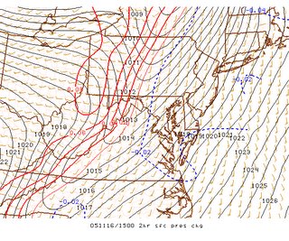
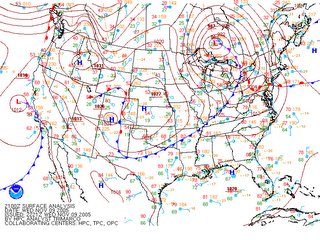
Currently, a vigorous cold front is analyzed near western MD, southwest towards extreme western Tennessee. The image at right is from the Storm Prediction Centers experimental mesoscale analysis page-notice the thin red line near the said regions, and the dashed blue line to the east. These isopleths (called isallobars or lines of equal pressure change) clearly identify the location of this intense frontal system, right along to thin red line running southwest to northeast into central PA.

Outlook:
Clouds are thinning east of the front, allowing surface temperatures to rise into the lower 70s under a tongue of moist, tropical air. Showers are breaking out across portions of north central MD, north Western VA and WV at this time. There are reports of winds gusting to near 40 mph in these showers, and continue to expect gusty winds through the day.

As for thunderstorms--the Sun is currently out across much of eastern MD, destabilizing the atmosphere. I expect isolated cells/lines of convection to bubble up over the next few hours, as the cold front makes its progression towards our area. There is a slight risk of severe thunderstorms across the entire region (east of the cold front) through this afternoon. Winds in thunderstorms have the potential to gust up to 60 mph.

In the higher elevations of the Appalachians, post-frontal precipitation will lag behind as temperatures dip into the lower 30s. Any remaining showers after nightfall will likely turn over the snow or a rain/snow mix.

Temperatures in the general metro region will fall into the upper 30s/lower 40s, and breezy northwest winds of 15-30 mph will make it feel like late December.

Any remaining precipitation will have moved out of the region by Thursday morning.

Extended Chill to the Weather:
Medium range guidance continues to suggest below normal temperatures will dominate the weather over the next week or so. The European model suggests a positively tilted trough (aligned southwest to northeast--opposite of a negatively tilted trough which is aligned southeast to northwest) will remain more or less locked in position along the eastern US.

Temperatures at least through next week/Thanksgiving will remain in the upper 40s/lower 50s.

After this, a more complex set-up emerges. Forecasters during long-range prognostications utilize what is known as the NAO, or North Atlantic Oscillation-one of the key features in winter weather forecasting, as it almost ALWAYS brings below-normal temperatures to the east. There are two phases to the NAO, a positive and negative. Positive NAO is usually responsible for above normal temperatures and fewer coastal storms, while the negative NAO favors below normal temps and a stormier weather pattern.

I believe that we are headed towards the latter situation. A large ridge is forecast to develop in the north central Atlantic, allowing a deep trough to invade the continental US. How cold it gets depends on the position and intensity of this trough, along with the intensity of the North Atlantic Oscillation.
By Lee Carlaw On Wednesday, November 16, 2005 At 10:50 AM
|

Cold weather's knocking

SEVERE WEATHER *POSSIBLE* TOMORROW AFTERNOON...COLDER AIR TO INVADE THE MID ATLANTIC

Outlook:
A warm front has just cleared the DC metro region, and continues to press slowly northward with time. Winds have swung around to the south/southwest, drawing a warmer, and more moisture-laden airmass into the area. Through the day, there is a very small chance of precip (less than 30%) as forcing mechanisms (i.e. the cold front/warm front) will remain removed from the region until later tonight. Don't be surprised to see a few breaks in the clouds through the day.

By tomorrow morning, a powerful cold front is situated on the western side of the Appalachians, and POPs (Probability Of Precip) increase to around 50-60%.

Severe weather:
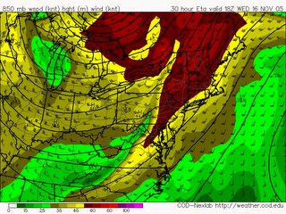
With the prospect of a vigorous cold front and moist air sliding towards the region, there is a concern that a few severe thunderstorms may bubble up during the afternoon Wednesday. One tool forecasters utilize to predict severe weather/thunderstorms is a thermodynamic profile known as CAPE, or Convective Available Potential Energy), which is measured in Joules/Kg. Generally, values above 2000 J/Kg will support vigorous thunderstorm updrafts, while values below 500 J/Kg or so are not as favorable for convective initiation.

However, given the speed of the low level jet (around 5,000 feet) progged to move over the region tomorrow, CAPE values around 200-400 J/kg, and good moisture content, there is the potential for some severe thunderstorms with damaging wind gusts, and possibly an isolated tornado.

Image Above: 850mb Wind speeds/heights. Red colors indicate very fast wind speeds. Courtesy of College of Dupage Weather

Heavy Rain:
While cold fronts are not generally dubious rain producers, there is a good probability you pick up rainfall amounts from .5-1 inch, and in isolated locations that receive thunderstorm downpours-don't be surprised to find totals near 2 inches.

Wide-spread flooding is not anticipated at this time.

Colder Air invading the region:
Tomorrow's temperature forecast is tricky. The cold front is progged to pass the area between 2PM to 8PM depending on where you live. Temperatures during the morning will likely rise into the mid 50s, but depending on when the front moves through, high temps may range from 55-65.

By Thursday, high temperatures fall into the mid 40s, and stay there into the weekend. Saturday and Sunday will remain below average, with highs in the lower 50s, about 5-10 degrees below average.

And by around Wednesday the 23rd (the day before Thanksgiving), we *may* be in for a little treat of some rain/snow showers in the metro region. Given this forecast is nearly 200 hours away, there is a lot of uncertainty, but the GFS model has been fairly consistent rolling a clipper-like system through the eastern United States during this timeframe, and surface temperatures may be marginally favorable for rain and snow showers...

By Lee Carlaw On Tuesday, November 15, 2005 At 10:24 AM
|

Evening Update and Extended Outlook

Temperatures today made it into the mid 60s in most locations under a thick canopy of low and mid level clouds associated with a fairly large upper level disturbance rotating around the upper Midwest. Presently, a few very light and patchy areas of showers are present the eastern portion of Maryland.

A warm front is currently developing along the tail end of a retreating cold front from Tennessee, arching back towards eastern Oklahoma. It is here that a powerful surface cyclone (surface low) will develop in tandem with this warm front over the next 12-24 hours-and eventually track towards the east coast by Midweek.

Tonight: Clouds will hang tough through the night as mid level moisture streams into the region from the southwest. As a result, temperatures will have a hard time falling below the 50 degree mark, although there may be a few locations in northern MD that touch 48-49 early tomorrow morning. A 30-50% chance of showers will develop after midnight.

Tomorrow: By mid morning, a warm front will have moved north of the region, taking a large chunk of the precipitation chances with it. As the front clears the region, there may be a few locations that break out of the cloud deck for a short period during the afternoon. Through the day expect something like a 20-40% chance of showers depending on your location.
Wednesday: The real fun stuff arrives during the day Wednesday in the form of a strong cold front. Precip chances will increase rapidly through the late morning hours, and I can't rule out the possibility of a few thunderstorms embedded in the larger rainshowers line during the afternoon.

The cold front clears the region by 7-9 PM Wednesday, and temperatures will begin a quick retreat into the upper 30s/lower 40s. Areas of western MD and eastern WV have a chance of seeing some snow flakes fly Wednesday night and into Thursday morning as cold Canadian air plunges southward into the Mid Atlantic.

Talkin' Tropics:
Yes, I know it's the middle of November, and in "normal" years we wouldn't be talking about tropical entities at this time. But as we have seen over the past several months, this is nothing like a "normal" hurricane season.

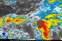
Tropical depression 27-as noted before-is still spinning around just west of the Leeward Islands. This system is expected to become tropical storm Gamma sometime tonight or tomorrow.

Top Image courtesy of NCEP/HPC
Image at right courtesy of the NHC.

Extended Outlook:
After this week's frontal passage, surface temperatures take a decent-sized dip below normal (average highs are just around 60, I might add) through the end of the week, and likely into the Thanksgiving weekend. For mid-longer ranger prognostications, I like to employ the well performing European Model (ECMWF).

ECMWF 500mb height Forecast valid Wednesday, 11/24 AM


The above image is the European Model's analysis of the day 7-10 mean 500mb Geopotential height field. (Green/Blue colors are lower heights-->lower temps). Notice the mid level trough depicted in the east, and the two ridges in the West Coast, and central Atlantic.

Given the depth of this trough, and its position, it appears locations along the Eastern Seaboard will remain below average through the Thanksgiving weekend and possibly beyond. Precipitation chances I'm not so sure about, but if a storm does develop, the primary form of precip would be rain (heights, although below normal, are still too high to support snow aggregation).
By Lee Carlaw On Monday, November 14, 2005 At 5:39 PM
|

Colder Air awaits--A wet and wild week ahead

COMPLEX WEATHER SCENARIO NEXT SEVERAL DAYS

As a low pressure system begins to get organized in the Midwest, a warm frontal boundary will begin to develop in the Ohio River Valley later today/tonight. By midnight, the warm front is knocking on the Nation's Capital, spreading a good chance of rain showers over the region.

By Tuesday afternoon, this front has shoved its way north of the region--opening us up to a region known as the warm sector to the east of a cold front, but south of a warm front. Temperatures Tuesday soar into the mid-upper 60s under mostly cloudy conditions.

Don't be surprised to see a few hints of sunshine here and there Tuesday afternoon as a strengthening frontal boundary approaches the region from the west. The real fun stuff gets in here Wednesday morning as the cold front races through the region, opening the door up for much cooler air to migrate southeast into the Mid Atlantic.


Showers will likely turn over to snow showers in higher elevations of the Appalachians Wednesday night, and lows will fall into the upper 30s closer to the metro region.

High pressure nestles into the area Thursday and beyond, keeping cooler Canadian air locked in place through the weekend. Highs Friday may struggle to make it out of the 40s in many locations-and don't expect high temperatures near 60 any time soon after Wednesday's frontal passage.

More Tropical Weather?!!
Yeah, that's right, and if you don't believe it-check out the
National Hurricane Center's Homepage. Tropical Depression 27 formed earlier this morning--and is expected to become TS-Gamma in the near future.


The Hurricane Center develops this system into a hurricane in 4-5 days as it nears Central America. What a wacky Hurricane season this has been (and we still have 15 more days of "official" Hurricane Season left).
By Lee Carlaw On At 10:48 AM
|

Nice close to the Weekend-changes on the horizon

Outlook:
The weather today remained a little on the brisk side with high temperatures ranging from the mid 50s to the lower 60s.

Tomorrow, temperatures will surpass what they hit today -as they climb into the mid 60s. As surface temperatures warm into the lower 50s, winds will once again increase out of the south/southwest at 10-20 mph under mainly sunny conditions.

Clouds begin to thicken Sunday evening as a weakening cold front makes an approach on the region. Most of the dynamics associated with this system will remain well north of the region, keeping the chance of precipitation to a minimum Sunday night/Monday morning.

Say Hello to Old Man Winter. . . well sort of:
Late Monday night, a very intense low pressure system will begin to develop in the upper Midwest (known as cyclogenesis). As the low deepens, a warm front will approach the region from the south very late Monday night/Tuesday Morning. As this ocurrs, lifting associated with the developing frontal structure will allow showers to develop/expand across the Mid Atlantic.

By Wednesday morning, the strongest cold front of the Fall season is knocking at the region's western doorstep, and clears the District by Wednesday afternoon/evening. (Note...timing differences exists between various weather models that have yet to be worked out).

After the front passes, surface temperatures fall off quickly into the low-mid 30s out west (possibly lower) Wednesday night. Based on their latest discussion, the weather service seems a bit concerned about Precip-type after the front passes, especially on the western flank of the Appalachians as temperatures plummet into the range favorable for snow-growth processes. At this point, surface temperatures in the immediate metro region do not look to favor any type of rain/snow mix post frontal passage.

Image above right: Strong surface low in eastern Canada, with a surface cold front over the Eastern Seaboard. Courtesy NCEP

Temperatures Thursday fall into the lower 50s, and possibly fall into the upper 40s by Friday/Saturday of next week.

Weather Underground develops new Satellite viewer:
After unveiling their new NEXRAD products with rain/snow line capabilities last month,
Weather Underground has developed another great analitical tool-an improved satellite/radar viewer for the United States (click here). The interface allows viewers to pan, zoom, loop, and overlay various fields onto the satellite image.
I thought this was pretty neat.
By Lee Carlaw On Saturday, November 12, 2005 At 6:46 PM
|

Veteran's Day Snow Memories

FREEZE WARNINGS ARE IN EFFECT FOR DC AND POINTS EAST UNTIL 6 AM TOMORROW MORNING

Do you know your weather history?
It seems fitting that on one of the colder nights of the year we celebrate the 18th anniversary of the largest, earliest snowfall in the Nation's Capital during the Veteran's Day Snowstorm of 1987. Nearly 12 inches of the white stuff piled up in the immediate metro region, and higher amounts near 15-19 inches occurred in areas east of the city.

Image Left: Photo shot during the 1987 storm. Courtesy of the Weatherbook.com


Outlook:
Clear skies and light winds will combine tonight to allow temperatures to drop into the low-mid 30s in most locations around the region, hence the freeze warnings in effect overnight. Temperatures tomorrow, however, will rebound quickly into the low 60s under mainly sunny conditions as high pressure continues to nose into the region from the southwest.

Colder air waiting to make an entrance:
As discussed in the previous post, cold air continues to build in extreme northern Canada, as noted by the -30F temperature readings in the Northwest Territories and Victoria Island.

Mid level heights (ie. at the 500mb level or about 18,000 feet up) are well below 5,200 meters, which is significantly below normal (at least for the continental US). To put 5,200 meter 500mb heights in perspective for you: if those kind of heights were present over the Capital, high temperatures would likely only be in the single digits to near 0 degrees.

It is looking more and more likely that at least a chunk of this very cold Canadian air breaks off and begins a journey to the southeast towards the US boarder over the weekend and early next week. As heights crash in response to this approaching trough/surface cold front, highs fall back into the low 50s-and some models even take temps into the upper 40s by the end of next week.
By Lee Carlaw On Friday, November 11, 2005 At 5:09 PM
|

Cold weather for Veteran's Day

Temperatures are currently hovering in the upper 40s across the DC metro region, with areas to the west like Johnston, PA coming in with a 31 degree reading at this hour. Brisk northwest winds 10-15 mph are making things feel even colder, so make sure to bundle up as you head outdoors today--high temperatures will struggle into the mid 50s by afternoon.

Outlook:
Temperatures will begin to moderate somewhat by tomorrow and Sunday as a surface high/upper level ridge take center stage over the eastern United States. By Sunday afternoon, lots of sunshine and warm air moving into the region from the southwest will combine to deliver us a spectacular close weekend with highs nearing 70 degrees.

After that, a remarkable change in the atmosphere begins to take place. Over the past weeks and months, cold air has slowly been gathering in northwestern Canada as several intense rotate, and hang around north of the 30th parallel. The only reason we haven't had a taste of this very cold air is due to a lack of mechanisms being utilized to shove the cold dome southeastward.

Recent model runs, like the GFS ensemble and ECMWF indicates at least a piece of this "cold dome" breaks away and moves southeast under a massive trough during next week. There is discrepancy regarding the strength of the trough, and hence, the amount of cold air that escapes into the continental United States, but I do expect high temperatures (after Wednesday) to fall significantly into the upper 40s/near 50.

Now what is remarkable about this developing weather pattern is ridges do not become apparent to disrupt the colder air mass. In previous weeks, cold air has enveloped the region for only short periods of time, like 1 or 2 days, before an upper level ridge moved into the area, bumping the temperatures back up to average norms. It appears the cold air will become entrenched on the region for an extended period of time, through the end of next week, and possibly into Thanksgiving...we will wait and see.

So at the end of this rant, the synoptics come down to this: warm air returns briefly to the Mid Atlantic through next Monday/Tuesday before a strong cold front races through the region sometime during the midweek, chopping temperatures by nearly 10 degrees into the upper 40s/near 50. Still, at least to me, cold air is pointless unless it's accompanied by snow...

Image above right courtesy of College of DuPage: ECMWF model Wednesday night, showing colder temperatures approaching the region with the passage of a strong coldfront.
By Lee Carlaw On At 10:09 AM
|

Cooler air waiting in the wings

Weather synopsis:
Currently, a powerful surface low is hanging out in eastern Manitoba with a strong cold front arching back towards the southwest from central Ohio into northern Texas. A surface warm front has pushed its way north of the immediate metro region, which has allowed winds to swing around to the south, drawing in a somewhat muggier airmass (although you probably wouldn't notice the difference).

The low in Manitoba has deepened at a very respectable rate, loosing close to 20 mb of pressure in the past 24 hours.

Severe weather:
While severe weather in the metro region is not expected, a tornado watch is in effect until 10 PM for eastern Ohio and western PA as a strong cold front races through those regions.

Given the degree of upper level dynamics, there is a chance a few of these thunderstorms survive the trip over the peaks of the Appalachians into MD and northern VA later tonight, although any chance of severe weather will have diminished to near Nil. Still, the local NWS office is somewhat concerned about cells popping up and developing rotation given very favorable speed shear (change of wind speed with height).

Outlook:
As with the previous frontal passage last week, most of the moisture associated with this next system will be contained to areas west of the mountains and north of the Mason-Dixon line. Granted, there is a chance (40-50%) a few showers/thunderstorms develop overnight around the region.

By the time many of you wake up, the cold front will have cleared the area, ushering in stiff northwesterly winds of 15-25 mph with higher gusts. High temperatures will be slashed by a good 5-10 degrees in most locations--near 55--as cold, Canadian air is drawn southeastward by the strong northwest winds.

However, by the weekend, high pressure becomes entrenched across the Mid Atlantic, allowing highs to once again rise into the mid-upper 60s, before another front (this time a bit weaker), approaches the area Monday morning.

The weather Forecasting Handbook-Tim Vasquez:
I purchased this book about a week ago, and have thoroughly enjoyed running through it. This handbook contains a wealth of information, beginning with the basic physical concepts like mass, distance, force, etc., eventually leading into the fundamentals and mechanics of weather forecasting.

I would highly recommend this to anyone interested in the functions of weather forecasting. Some previous background knowledge of basic weather concepts is a good idea before picking this book up, but it is still a good read for the 'weather weenies' out there.

The Weather Channel goes comedic:
Both the Washington Post and CNN report on the Weather Channel's attempt at raking in more viewers by airing celebrity guests on the show. Black will get a chance at the "chroma key," you know-the big green screen with nothing on it that broadcast meteorologists stand in front of-alongside David Schwartz, and add some comedic value on global warming. Tune into the weather channel Wednesday night, November 9th to catch some of Lewis Black.

This added comedic value comes at a time when the Weather Channel is attempting to increase the number of viewers. Lately, the weekend segments feature the forecasters on couches, resembling a "Today Show" style, instead of behind the gray desks.
By Lee Carlaw On Wednesday, November 09, 2005 At 6:07 PM
|

It looks like Rain

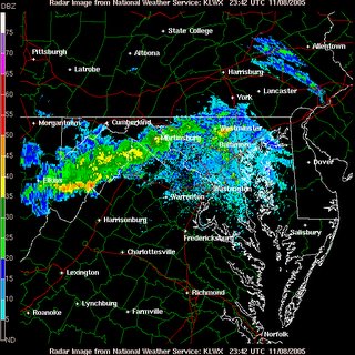
A bit of a hiccup tonight that has come as a bit of a surprise. I was not anticipating clouds and showers moving into the region this early, but a narrow swath of rain showers extending from North Central MD through central WV continues to move southeastward in association with a mid level feature rotating through the region.

Tonight:
As this vigorous swath of rain showers and a few embedded thunderstorms continues its track towards the DC metro, a steadily increasing chance for precip will develop through the next couple of hours. Granted, the best chance for any significant precipitation will remain north and west of the immediate metro region given the proximity to better forcing and upper level dynamics (more moisture, spin, or "vorticity" in the atmosphere).

Image above: Vigorous line of showers/embedded thunderstorms moving southeast towards the District. Courtesy of the NWS

Tomorrow:
As this first system pulls away, another one enters the stage in the form of a cold front late in the afternoon/evening. A chance for showers will linger through much of the morning, but will increase significantly closer to sunset as a low pressure system makes its move on the area. Still, the bulk of the moisture (similar to the last system-but with different dynamics) will remain north of the region and west of the mountains.

Thursday:
The cold front races through the region by daybreak Thursday, ushering in somewhat cooler temperatures as highs may not be able to break 60 Thursday afternoon.

Winds: As the front pulls away, the combination of a high pressure cell to the southwest, and a strengthening low to the northeast will combine to form some blustery conditions across the region both Thursday and Friday. Winds Thursday will likely be gusting past 30 mph during the afternoon.

Temperatures begin to moderate again as a midlevel ridge moves into the area. Highs Saturday will once again approach the mid 60s, and may once again approach 70 on Sunday.

Thunderstorms: The SPC has our area outlined for a slight risk of severe thunderstorms tomorrow, although the approaching trough/cold front lacks much in the way of a strong thermodynamic set-up (i.e. low level CAPE/Instability, warm low level temps, etc.) Most of the heafty instability is progged to remain south of the region during the day, and slowly migrate eastward by nightfall. From 5-10 pm it's not unlikely a few thunderstorms bubble up with the approach of the cold front, but should mainly be on the weak end of the spectrum.
By Lee Carlaw On Tuesday, November 08, 2005 At 6:45 PM
|

Cool weather on hold for awhile

After a cold frontal passage last night, dewpoints have fallen nearly 15 degrees into the upper 30s/near 40. High temperatures today will be about 10 degrees cooler than they were yesterday given slight cold air advection (movement of cooler air into our region), and they should remain in the upper 60s.


Tonight, as winds relax and the sun sets, temperatures will begin to fall into the lower 50s, and eventually bottoming out in the lower 40s by dawn tomorrow.

NBC4 City Cam-Courtesy of NBC weather

Outlook:
Over the next day or two, we will be under the influence of a generally zonal flow, or a flow of the jet stream that aligns itself in a west to east fashion over the Continguous United States. This type of pattern generally favors mild temperatures in our region and very little in the way of 'interesting' weather. With this type of pattern, any 'cool' air induced by a frontal passage is short lived as midlevel ridges build back into the region shortly after the frontal passage.

Wednesday through Veteran's Day
During the midweek, an upper level trough amplifies (strengthens) and digs southeastward into the Mid Atlantic. This results in another cold frontal passage associated with a low in eastern Canada late Wednesday/Thursday morning. High temperatures Wednesday will be in the upper 60s, but will cool down into the mid 50s for Thursday and Veteran's Day.

Saturday and Sunday
However, as explained before, the cooler temperatures are short-lived as high pressure once again builds back into the area, inducing temperature modification by Saturday and Sunday as highs once again climb into the mid/upper 60s.

Time permitting, I will be able to make a longer range forecast (into mid/late November) sometime later this week.

Tornado in Indiana
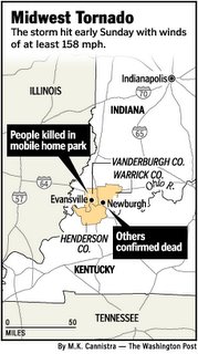
As the title of a recent article published by the Washington Post reads:
"Everything people Worked for Is Gone," indeed, houses, businesses, and lives have been shattered by a 30 second blast of 160 mph wind concocted by Mother Nature. A quote from the above article reads:

"It's terrible, man. I'm heartbroken," said McDonald, who arrived with a crew from Zion, Ky. "Everything people worked for is gone. Lives are gone. Children. This ain't even my community and I felt like crying all the way back to the street."


These scenes of devastation coming out of Indiana and Kentucky are a poignant reminder of the awesome fury that weather can unleash on any individual.

Image right courtesy of Washington Post

By Lee Carlaw On Monday, November 07, 2005 At 10:09 AM
Contact Us
wxdude1990 (at) yahoo.com jyarsh381 (at) hotmail.com

Donations


Useful NOAA Weather Links
Local Weather Service Office
Hydrometeorological Prediction Center
Storm Prediction Center (Severe Weather)
National Hurricane Center

Watches, Warnings, Advisories
Warnings

Numerical Weather Models
NCEP Models (good selection)
PSU E-Wall
25 km WRF model (Hi-Res)
Earl Barker's Model Page
Ensemble MOS data (Washington, DC)

Radar and Satellite
Local Radar

PSU E-Wall Satellite
Local NWS radar
ABC Radar
FOX Radar
NBC Radar

Other Weather Blogs
Capitalweather.com
USA Today's The Weather Guys
The Weather Underground blog
Foot's Forecast
Weather Talk Radio
Eastern US Weather Forum
Phillyweather.net

Other Blogs
BayArea Kicks

Enter your e-mail to subscribe:


Personal Blogs - Blog Top Sites

Subscribe

Personal blogs
Top Blogs

Creative Commons License
This work is licensed under a Creative Commons Attribution 3.0 License.

Archives