Local Forecast
Weather Wars: 7 Day Forecast Battle
Days Mon Tue Wed Thu Fri Sat Sun
Lee C. -- -- -- -- -- -- --
John Y. -- -- -- -- -- -- --
Temperature Verification
Days Mon Tue Wed Thu Fri Sat Sun
Temps -- -- -- -- -- -- --
|

We're off to a good Start

The weather today will cooperate for many of you, as clouds scatter out of the region, and temperatures rise into the lower 60s.

Superrefraction and Ducting...Pay attention:
With all the fog this morning, a high moisture content was hovering a few meters off the ground, before decreasing rapidly with height above 100 feet or so. This type of regional weather set up; that is, one with a large amount of ambient moisture close to the ground, and a low amount of moisture a few hundred feet up, creates a phenomenon on Doppler Radar known as superrefraction and ducting. The radar beam becomes bent, and in this case, bent in such a degree as to intersect back with the earth in north central VA. When the radar beam comes in contact with the earth, high reflecitivies are revealed on the radar, known as as anomalous propagation.

Forecast:
A low pressure system will develop overnight before moving up the east coast tomorrow morning. Rain showers will once again overspread the region, lasting through midday, before pulling out by the evening rush. There is a slim chance (better chance in the mountains) that some of the showers change over/mix with snow towards the noon hour tomorrow. No accumulation anticipated.

Long Term Outlook:
As you may have heard, the temperatures in Alaska remain brutally cold (some readings around 50 or 60 below zero). Current indications are that this cold gets set loose within the next 180-200 hours, and coagulate in central Canada for a few days. By the 6th or 7th of February, we should begin to feel the effects of decreasing temps, before plunging into a well below-average temperature regime around the 10th-15th.

Some GFS ensemble members (a specific long-range numerical model) push sub 5280M heights at 500 millibars into the region, which happens to be a considerably low atmospheric height for our area. Normally, temperatures associated with sub 5300M heights at this time of year plunge into the 20s and 30s

Just some good stuff to look forward to...

By Lee Carlaw On Monday, January 30, 2006 At 10:11 AM
|

Bleak close to the Weekend

The Knickerbocker Disaster
It's hard to imaging that a day when temperatures soared into the upper 50s under crystal-clear skies, is also host to the deadliest snowstorm on record for the Washington, D.C. Metro region. On a particuarly gloomy day 84 years ago, nearly 30 inches of heavy, wet snow had accumulated over the region associated with a powerful Nor'easter, which expelled a pressure roughly around 20 pounds per square foot on the roof of Crandall's Knickerbocker Theater in downtown D.C. At 9PM, the tremendous weight of the snowfall split the theater's roof down the middle, killing 98 individuals and seriously injuring another 130.

Image courtesy of Weatherbook.com

Gloomy Weather tomorrow:
Needless to say, we won't be expecting a 30-inch snowstorm any time soon; in fact, we're expecting just the opposite--rain showers. A powerful jet stream racing through central Mexico and southeastern Texas is pumping tropical moisture northward into the Ohio River Valley. A surface low pressure system will gradually slide northeastward into the Great Lakes region by tomorrow morning. Showers will overspread the region during the early afternoon hours on Sunday, before racing out of the area around nightfall.

As for our *potential* wintry episode next week, things are still up in the air. It's basically a given that a secondary low develops along a stalled surface front Monday evening, but exactly when and where are still issues that have yet to be glossed over.

The National Center for Environmental Protection, the agency that developed the GFS, NAM (formerly the ETA), RUC, and WRF, recently dropped profilers in the North Pacific to give numerical model guidance a better edge in forecasting next week's storm system. (The basic principal behind this being the 'weather' moves in a predominantly west to east fashion following the jet stream, and the drops will allow the models to analyze upper weather features more accurately in tonight's runs). This added analysis data may end up throwing a monkey wrench into ongoing forecasts, but hopefully we can shed some more light on Tuesday's weather potential.


As with all the storms this season, there is no real source of cold air. We usually like to see a healthy high pressure dome in Upstate New York to funnel cold surface air into the Mid Atlantic (guess what, it's not there). So, any cold air will be completely low pressure induced, meaning as the low strengthens, it will have to do so quickly enough to pull colder mid-level air down to the surface before precip moves out of the region.

I'm not wowed by our chances for snow, but it's still there. I would say accumulating snow is out of the picture, but time will tell...
By Lee Carlaw On Saturday, January 28, 2006 At 8:34 PM
|

Clear but Cool Close to the Work Week

Forecast:
After a chilly start to the day, temperatures will quickly warm into the upper 40s/near 50 by mid-afternoon under clear conditions.

For Saturday, temperatures will once again soar into the upper 50s as high pressure propagates eastward, which will turn variable winds to the south. High cirrus clouds will overspread the region during the mid-morning hours, quickly followed by lowering stratus as a developing low skirts the region. Scattered showers should develop towards 3-5PM, although the day will not be a washout.

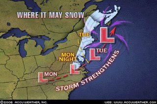
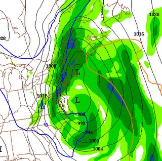
The chance for showers will remain through Sunday night, before decreasing through the day Monday (although the risk for a passing shower will remain). By Monday night, a surface low should begin developing along a stalled frontal boundary in the southeast, which will deliver a second punch of rain showers to the region overnight and through Tuesday. A few models however, develop this said low into a vigorous nor'easter Tuesday evening as it races northeastward towards the Grand Banks. (Could this mean snow for the region?) The Quantitive precipitation Forecast map to the right (NCEP/NOAA) shows nearly 1.5 inches of liquid-equivalent precip through Wednesday (how much of this, if any, is snow is a coin toss at this point).

The folks at LWX (the National Weather Service office for the Washington's/Baltimore area) also see this potential for a wintry concoction next week:


SECONDARY SURFACE LOW DEVELOPMENT APPEARS LIKELY AS THE SYSTEM MOVES TOWARD THE MID ATLC COAST...INDICATED BY THE GFS/CANADIAN AND ENSEMBLES. THE LOCATION OF THE SECONDARY DEVELOPMENT WILL HAVE A BIG IMPACT ON THE MONDAY NIGHT/TUESDAY FORECAST. 00Z GFS WOULD SUGGEST THAT THE SECONDARY DEVELOPMENT WOULD COMMENCE OVER EASTERN NC. THIS WOULD ALLOW THE COLD AIR TO COME RUSHING BACK SOUTHWARD AND GIVE THE POTENTIAL FOR FROZEN WINTER PRECIP. PREVIOUS RUN IS WEAKER AND FURTHER NORTH WITH THE DEVELOPMENT AND WOULD KEEP PCPN IN THE FORM OF RAIN. FOR NOW HAVE FORTIFIED THE POPS A BIT FOR MON NIGHT/TUE AND HAVE NOT MADE ANY SIGNIFICANT CHANGES TO THE WEATHER GRIDS. SNOW WILL HAVE TO BE CONSIDERED EAST OF THE MOUNTAINS IF MODEL TRENDS CONTINUE.


Needless to say, we'll be watching this system over the weekend, and that forecast confidence--at this point--is minimal at best.
By Lee Carlaw On Friday, January 27, 2006 At 10:01 AM
|

Now this is Winter!

Quick Reminder of Winter stirs Snow-Lovers:
I must first congratulate meteorologist Tony Pann of 9 News for his forecast made last week. He was able to see the potential wintry weather we experienced last night/today 5 days out. Most, if not all the numerical model guidance killed any precipitation trying to move into the region as it crested the Appalachian mountains. There were a few reports of thundersnow, (just as it sounds; heavy snow in a thunderstorm) in north central Maryland last night, and a band of snow showers raced through the metro region earlier this morning. Kudos to Tony...

Forecast:
Tonight: I don't know about using the word "bone-chilling" to describe the weather as accuweather meteorologists have on this graphic, but you have to admit, the image itself is pretty imaginative. Winds will slacken somewhat overnight as the pressure gradient (see post below) relaxes. Temperatures will dip into the mid to upper 20s under mainly clear skies.

Tomorrow through Saturday: Generally clear conditions through the rest of the week as strong high pressure builds in overhead. Temperatures Thursday will be near average (43), but as the said high moves east, a southwesterly flow will draw warmer air (once again) into the region for the weekend. Highs in the mid 50s on Saturday are not out of the question (another good golfing weekend?). This is supported by higher than normal height anomalies in the central United States that will progress eastward over the next few days.

Sunday-Wednesday:Clouds thicken Sunday afternoon in response to an approaching low. Rain showers look to develop late Sunday night, and last through the day on Monday. A few models suggest some wrap-around precipitation mixes with colder air on Tuesday to throw a few snow showers our way before clearing takes place during the afternoon.

TV Special:
Set your VCR or be ready to watch Doug Hill's special on the highly-hyped introduction of the WeatherBug Network tonight at 8:00 PM. You can tune into this Hill-hosted special on Channel 7 (broadcast) or channel 27 (cable).
By Lee Carlaw On Wednesday, January 25, 2006 At 10:17 AM
|

Windy weather ahead

WIND ADVISORY IN EFFECT FROM 9AM TO 5PM TOMORROW. WIND GUSTS TO 50 MPH ARE POSSIBLE BEHIND A STRONG COLD FRONT


Cold Front Pressing forward:
After afternoon temperatures near 50 degrees, a return (once again) to the ever absent "normal" weather is in the offings for the region. A powerful cold front, associated with a developing (and intensifying low) near the US/Canada border, will sweep across the Ohio River Valley this evening, before setting its sites on the metro region overnight.

After the cold front axis passes, you will notice (If you're up at say 4 or 5 AM) the winds quickly begin to ramp upwards. This is caused by a weather phenomenon known as the Pressure Gradient Force, which is defined as:


Therefore, as the spacing between isobars (lines of equal pressure) decrease over a distance, the PGF increases, a figure that is correlated to wind speed. For example: in the image above, the PGF over the Mid Atlantic is something like 1 mb per 100 km, not a very strong one, and therefore, we'd expect generally light winds in the region. However, behind the cold front, the PGF ramps up to about 4 mb per 100 km (rough estimate), and we'd anticipate wind speeds to be significantly higher to the west of the cold front.

So, as the front passes, the PGF will gradually increase, incrementally forcing the surface winds higher as air moves more quickly over a specific region. On top of all this (as if it weren't enough) the release of solar energy as the sun rises has a stark effect on wind speeds. By 7 or 8 AM, the overnight inversion or increase in temperature with height to about 1000 feet, erodes as the surface warms. This allows any quickly moving air in the upper levels to be easily transferred to the surface, further increasing the wind speed. With this in mind, wind gusts to 40 or 45 mph are anticipated tomorrow afternoon.

That's your lesson for the day...

Temperatures should warm above average once again by this weekend.
By Lee Carlaw On Tuesday, January 24, 2006 At 6:17 PM
|

Welcome back, winter

For the first time in a long while, it actually feels like January. A strong cold front moved through the region last night, and is currently stalled across the Southeastern US. Moisture associated with a developing low off the Texas coast will slowly progress northeastward over the next 12-24 hours, and clouds will slowly begin to thicken as the day wears on.

Showers are set to invade the region overnight from southwest to northeast. By late Monday, most of the rain shower activity will have moved east of the Mid Atlantic, opening the door to a strong Canadian high pressure cell which will slide into the area during the middle of the week. Temperatures will fall back towards "normal" values, and even slightly below as northerly winds drag cooler Canadian air into the Eastern United States.

Will Winter hold on for February?
The average January temperature at Washington Reagan National Airport [43.5 degrees, 8.6 degrees above average] has moved into 6th place as the warmest January on record, behind 1890 (+8.9), 1913 (+8.7), 1932 (+11.9), 1933 (+7.7), 1950 (+13.1*), and 1990 (+8.7).

For the snow-lovers, most of us have already thrown in the towel and decided that winter cannot possibly make a come-back before March. So, how do February's following extremely warm January's stack up?

In January's where the mean temperature exceeded 6 degrees above normal [1880, 1890, 1913, 1932, 137, 1950, 1974, 1990, 1998, 2002] the February that followed generally featured above normal temperatures; in fact, the average February temperature was 3.4 degrees above the 130-odd year mean. The average snowfall following such January's was meager at best, with an average of 1.3 inches falling at Reagan National, however, there is a caveat:

The North Atlantic Oscillation (NAO), which is the dominant mode of atmospheric behavior in the United States, remained within 1.5 standard deviations from 0 in the aformentioned years. Weakly positive, or weakly negative phases of the NAO generally have minimal impact on the weather in the Eastern US. Most numerical weather models, the GFS in particular, are adamant in developing a moderately negative NAO come February 1st, ranging anywhere from -1 to -4, which would favor colder conditions in the Eastern US.

In short, this is what I'm trying to get at: even though temperatures this month have been ridiculously high, things looks decent regarding a return to winter-like conditions come February, or at least for the first half of the month. There is some troubling data that would suggest the -NAO retreats after the 10th-15th of February, and force temperature back above normal. Still, the temperature forecast for February is on shaky ground. At this point my thinking is temperatures average anywhere from 0 to +1 above normal. Keep your fingers crossed...
By Lee Carlaw On Sunday, January 22, 2006 At 11:50 AM
|

What's that...It's January?

If I didn't know better, I'd be apt to say the weather around here is more reminiscent of early April than late January. So far this month, our maximum daytime temperatures have averaged nearly 52 degrees--more than eight degrees above normal--and high temperatures have consistently popped into the 60s; a rare occurrence in January, to say the least. (Oh, and by the way, Dulles set a new high temp record of 63 degrees today, breaking the 62 degree record set in 1998).

How often is it this Warm
But, how odd is it for temperatures to be this warm, this early in the year? The average monthly temperature (highs and lows averaged) is 34.9 degrees for January. Through the 19th, however, the January 2005 monthly average is a comfortable 7.8 degrees above normal, moving into 9th place for the warmest January on record (in 1st place is 1950, when temperatures for the month average close to 50 degrees, a staggering 13 degrees above normal!)

All things considered, the near record high temperatures we've been experiencing may not be that bad of a thing. Most people I've talked to--even though they crave some of what winter has denied Washingtonians this month--say they've been enjoying the early spring-like weather. Hey, even the golf courses have managed to stay open longer than usual.

There are, however, still signs that colder air makes a move on the region by the end of the month as a negative North Atlantic Oscillation sets up (some guidance suggests significantly low values) which would favor a return to below-normal weather conditions.
By Lee Carlaw On Friday, January 20, 2006 At 8:28 PM
|

Wintry mess tomorrow AM; Colder weather on the way

A Winter Weather Advisory is in effect for areas north and west of the District from 4AM to 9AM Tuesday morning. Icy road conditions are possible in the warned areas

After the ridiculously windy conditions we experienced yesterday, things have calmed down a bit as we remain trapped between two weather systems--one departing around the Canadian Maritimes, and a developing low in the southeast. Over the next several hours, significant upper level divergence (winds spreading out along a set area, opposite of convergence, where winds converge on a set location) aids in strengthening the said low.

By mid-morning tomorrow, rain showers will have taken over the southeast portion of Maryland, and a potential wintry mix in the northwestern 'burbs as some shallow cold air remains trapped east of the mountains. With this said, there may be a few slick spots on the roadways north and west of the District tomorrow morning.

By Mid-afternoon, the bands of showers associated with a warm front punch north of the region, leaving us in a dryslot for a few hours before a strong cold front progresses over the Mountains. Hefty showers, and a few thunderstorms will break out once again overnight Tuesday and through the morning hours on Wednesday, before everything moves east of the region by 5 or 6PM.

Yet another chance for precip moves into the region next Saturday afternoon as another low develops in the Ohio River Valley.

As for temperatures, daytime readings will generally top out 10 degrees or so above average (in the lower 50s).

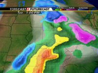
Image above right: Futurecast computer model showing the possibility of a little wintry-mix tomorrow morning

Good News for the Snow-Lovers
Over the past few days, a massive Cold Vortex has moved off the Russian coast, and is currently situated a few hundred miles west of the Gulf of Alaska.

This will begin to set the stage for a "pattern reversal" by the end of January as the North Atlantic Oscillation switches over to negative (good for winter stuff in the District), and cold air spills southward in the Contiguous US sometime around the 25th to 27th of January.

The image to the right is the 12z run of the European Model showing a trough developing in the Midwest, cold air spilling southward into the United States, and, more importantly, a Negative NAO as a positive height anomaly sets up over Greenland. It's far too early to pinpoint the potential for winter storms, but the developing pattern would seem to favor a snowy end to the winter season. Cross your fingers...
By Lee Carlaw On Monday, January 16, 2006 At 4:08 PM
|

Snow, High Wind, and Cold

High Wind Warning in effect 7AM EST Sunday, followed by a Wind Advisory until 4PM EST Sunday afternoon. Wind gusts to 55-65 mph are likely overnight

The highest wind gust I was able to find occurred a few hours ago in Washington, DC with the anemometer clocking a 54 mph wind speed. Surface winds are expected to continue increasing as the night progresses, and a few models pump out wind gusts topping 70 mph.

As the stiff northwesterly winds continue, and radiational heating is lost, surface temperatures will dip into the mid 20s-lower 30s overnight. Current Doppler radar images from Sterling, VA (the Warning Forecast Office for the Greater DC area) reveal a fairly elongated band of precipitation extending from north central Maryland, southward into Charlottesville at this hour. With temperatures falling at their current rates, there is a high likelihood that any precip currently falling as showers turns into snow within the next 1-3 hours.

Any snowfall accumulations are expected to remain below an inch, except out in the mountains, where 2-4 inches of snowfall is expected by Sunday morning.

There's a New F-Scale on the block:
Back in the early 1970s, Dr. Tetsuya Theodore Fujita developed a tornado rating system based on structural damage, at the University of Chicago. This rating system became known as the "F-scale," or "Fujita-Scale" and became a widely accepted damage indicator for the next 35 years.

However, beginning in February of this year, the "old" F-Scale will be replaced by a new "Enhanced" F-Scale that significantly lowers the wind thresholds of all 6 of the F-scale categories.

Below are the previous, and new F-scale rating systems as per the Storm Prediction Center's website:

Old F-Scale:
SCALE WIND ESTIMATE *** (MPH)
F0 <>
F1 73-112
F2 113-157
F3 158-206
F4 207-260
F5 261-318

New F-Scale:
SCALE WIND ESTIMATE *** (MPH)
F0 65-85
F1 86-110
F2 110-135
F3 136-165
F4 166-200
F5 Over 200

Image above right: Dr. Fujita, known as Mr. Tornado, was involved in extensive tornado surveys and studies. He invented the F-scale for measuring tornado damage. (Photograph from the University of Chicago Archive.)
By Lee Carlaw On Saturday, January 14, 2006 At 5:25 PM
|

Multi-Faceted Storm to Affect the Metro Region

Severe Thunderstorms, High Winds, and Snow expected over an eventful Redskins playoff weekend
Hold onto your hat's....Literally
For those of you who have been enjoying this mid-spring weather, you're going to be in for quite a shock tomorrow afternoon. Temperatures this week have constantly remained 10 degrees or more above average under partly cloudy skies, but all good things must end, right?

A massive storm system has begun developing in the Ohio River Valley in a "strongly diffluent upper level flow," which is just weather-speak for a rate at which wind flow spreads apart (left or right) of an axis oriented to the normal flow direction; this promotes strong cyclogenesis/low pressure formation and intensification.

Tonight, showers and thunderstorms will gradually increase in coverage as the low and associated cold front approach from the west. Indication are that the atmosphere will remain conducive for nocturnal thunderstorms even after much of the daytime heating has been lost. You often here that "thunderstorms cannot sustain themselves after dark because instability and temperatures have decreased." This is normally the case, but there are exceptions. Case in point, this latest system carries with it such powerful dynamics that strong to severe thunderstorms will likely develop and persist through the overnight hours.

The coldfront associated with this system will race through the region during the morning hours tomorrow, and surface temperatures will fall through the day. By afternoon, the low will have moved east of the region and winds will have begun increasing out of the northwest. Some model data indicates wind gusts in excess of 40-50 mph Saturday night and Sunday.

So here's an overview of impacts this system will have on the region:
  • Develop Thunderstorms (Some Severe)
  • Reduce temperatures by a good 30 degrees (by Sunday AM)
  • Wind Gusts to 40-50 mph
  • Significant Upslope Snowshowers on the Western side of the Appalachians
I'm not ruling out the possibility of a few snow showers mixing into the rain Saturday afternoon/evening as colder air makes its way into the region. However, most snow showers will be confined to the western side of the Appalachian Mountains where 3-6 inches of snow accumulation will be possible.
By Lee Carlaw On Friday, January 13, 2006 At 4:57 PM
|

Evening Update

A low pressure system situated northwest of the region is the culprit behind today's nasty weather and coolish temperatures (although, we were still nearly 8 degrees above normal for this time of year--we've just been spoiled rotten by the 55-60 degree weather as of late).

Those of you looking for spring-like weather are in luck-skies are expected to clear within the next several hours, and temperatures look to soar towards 60 ddegrees for the second time this week! We may have to stumble through a bit of early morning fog tomorrow, but this should all burn off by mid morning as incoming solar radiation warms the lower levels.

We basically have two days to catch our breath before a very potent mid-latitude low pressure system makes an approach on the region Friday night. Latest model indications indicate the potential that precip hangs around the region through Saturday afternoon as cold air marches eastward over the mountains. If enough low level moisture can remain around the metro region Saturday afternoon as temperatures fall under still northerly winds, the lagging precip may change over to a brief period of snow.

No matter what happens, however, winds will increase dramatically as this storm system departs. Wind gusts to 30 or 40 mph aren't out of the question, and you may hear your windows rattling overnight Saturday.

Now why Can't it Snow like this in DC?,


For the past few weeks, several snowstorms have blasted parts of Japan with 10-13 feet of heavy snow. The death toll, as reported by the Washington Post, has risen to 71. The main cause of death has been linked to roof failure under the tremendous weight of the snow. What a sight this would be in the Nation's Capital...
By Lee Carlaw On Wednesday, January 11, 2006 At 5:45 PM
|

Really Pleasant January Weather

Old Man Winter has decided to take an extended vacation from the Capital region, and for the first time in a long while, I was able to walk around outside in shorts, DURING JANUARY! Even though a cold front associated with a clipper low to the north passed through the region last night, temperatures will still manage to crawl 5-10 degrees above normal this afternoon.

Temperatures yesterday were able to top 60 degrees for the first time since November 29th of last year. While we won't be enjoying weather quite like yesterday's, temperatures today will still manage to crack 50 in most locations under partly sunny conditions.

Graphics courtesy of Accuweather, and PSU E-Wall

OUTLOOK:
On Wednesday, A developing area of low pressure in the Ohio River Valley should begin spreading low clouds and showers over the region by the early afternoon hours. I don't expect anything too severe tomorrow--mainly scattered, light rain showers. High temperatures should remain in the mid-upper 50s.

Thursday through Friday things clear out as we sit in between storm systems developing in the west, and departing lows over the Atlantic Ocean. Temperatures will take advantage of the increased solar radiation, and we will likely approach, if not top 60 degrees once again Thursday and Friday afternoon.

After this, things become quite interesting as many models develop an extremely intense cyclone in the Ohio River Valley once more over the weekend. Draw your attention to the image to the right. This graphic is what forecasters call ensemble model forecasting. Every numerical model has some sort of ensemble member forecast, and the images at right are those of the Global Forecast System (GFS) model.

This forecasting method was developed to improve medium and long-range numerical weather forecasting. Each run of the same model are started with slightly different initialization parameters (time, temperature, wind, etc.) to produce a forecast. If, at the observation time, all of the ensemble members are in reasonable agreement, the forecaster has better confidence in the forecast.

So, the graphic on your right is a host of negative, and positive perturbations (i.e. models where the physical properties of the atmosphere were changed slightly) of the GFS model at 102 hours valid early Saturday morning. As you can see, there is general model consensus of the placement and strength of an intense low pressure system affecting the region during this timeframe. But, as is normal at 100+ hours, there is some uncertainty regarding precipitation placement/onset times.

With this data, I can make a somewhat confident forecast for the weekend. Most of the ensemble members draw extremely warm/humid air from the Gulf Coast northward into the Mid Atlantic (notice that pink line jutting northward towards the Mid Atlantic, that's the 50 degree isotherm about 10,000 feet up in the atmosphere). Showers and thunderstorms will likely break out across the region late Friday night/Saturday morning, before exiting quickly during the evening hours.

Strong, northwesterly winds behind the system on Sunday will promote near normal, to slightly below normal temperatures in the upper 30s.
By Lee Carlaw On Monday, January 09, 2006 At 10:36 AM
|

Closing out the weekend: What's Next?

While we didn't close the weekend on a high note (chilly mid 40s weather under cloudy skies), all signs point towards an increase in air temperature over the next few days as the polar jet (pJ) is shoved northward into Southern Canada.

The Next Few Days:
Current indications suggest an anomalously warm airmass will move into the region this week, setting the stage for maximum temperature readings in excess of 10-20 degrees above normal!

I had to do a double-take looking at the weather models this evening when I saw forecast maximum temperatures peaking at 60 degrees tomorrow afternoon. A massive high pressure system off the East Coast will turn the winds around to the southwest, drawing in some of the record-breaking warmth in the Midwest. Expect variable cloudiness tomorrow with some clearing during the late afternoon as high temperatures peak in the upper 50s/lower 60s (that's about +15 above normal).

A weak cold front should traverse the region overnight Monday, shifting the southwesterly winds around to the northwest.

Tuesday: Some upper level moisture looks like it will make its ways into the Mid Atlantic on stiff westerly winds, inducing mostly cloudy conditions, and keeping high temperatures generally shy of 50 degrees.

Overnight Tuesday, a warm frontal boundary associated with a developing low in the Ohio River Valley will attempt to push north of the region. Some widely scattered showers may break out across the region after 3 or 4 in the morning.

Wednesday: Given our proximity to a rather large swath of moisture making its way northward from the Gulf of Mexico, it seems prudent to warrant at least a chance of showers through the day under cloudy skies. High temperatures will hover in the mid to upper 50s.

Thursday: There is a little model disparity during this timeframe. A few models suggest the moisture associated with the said low "hops" over the Appalachian Mountains, effectively bypassing the metropolitan region, and leaving us with partly sunny conditions. A few other models, on the other hand, suggest precip lingers around the Mid Atlantic even through Friday.
At this point, I don't feel safe going with a completely dry forecast Thursday. I expect some showers to mingle with the region during the early morning hours, before gradual clearing takes place during the afternoon. If this forecast pans out, high temperatures will likely soar into the upper 50s/near 60 once again.

Channel 4 Launches New Weather site:
Thanks to dcrtv.com for pointing this out. Channel 4 (NBC) recently released its "beta" version of their so-called Weather Plus webpage. You can gather a host of neat information and graphics from this new site, like local forecasts, local doppler radars, cloud/precip forecasts, and localized weather conditions.
By Lee Carlaw On Sunday, January 08, 2006 At 6:39 PM
|

Say Goodbye to the Warm weather--For a day

The warm weather has quietly exited the stage, and yielded the floor to a more seasonal airmass today. A cold front slid through the area (sans fanfare) last night, turning our southerly winds around to the northwest. This northwesterly wind will slowly begin draining cooler air into the region overnight tonight, as low temperatures dip to their lowest values in nearly 15 days, (projected low tonight is 25, and the last time we hit that number was back on December 25th).

Winds will also remain active today, and some gusts to 20-25 mph will be commonplace until nightfall.

Where's the Snow?
While December averaged nearly 4 degrees below normal 30 year values (43.2/47.0), this was primarily due to an excessively cold period during the beginning of the month. Even though we are barely through the first week of January, we are nearly 7 degrees above average for the month. Troughs have consistently affected the region, but a lack of blocking (something to hold the trough's in place) has been all but absent. Thus, the troughs and associated cold snaps move out to sea without introducing the really "cold" wintertime temperatures needed for DC snowstorms. The cold air is then known as being transient as it lasts for a short period of time before progressing eastward in the mean upper level flow.

Furthermore, the overall structure of the jet stream favored storm tracks either too far south of the region, or too far east to deliver any measurable snowfall/precipitation.

But fear not snow lovers. There are some signs that would point to a progressively colder pattern developing towards the end of January. How cold it gets is still up for grabs, but I'd keep an eye on the weather forecast at the end of the month.

Blizzard of 1996:
For those of you who were in DC 10 years ago today, you may remember one of the most historic snowstorms in recent memory, not only for us, but for folks all around the northeast. Although conditions never really made it to "blizzard criteria" around the Capital, it came close.

Anywhere from 15-30 inches of snow fell between the 6th and 8th of January crippling travel around the region for the entire week.

I figured, if we can't get snow now, we might as well look back on memories of a historic snowstorm.

Image courtesy of Ray's Winter Storm Archive
By Lee Carlaw On Friday, January 06, 2006 At 10:19 AM
|

We're Replaying the Old Record Again...

While the danger for extreme fire weather continues in the Lower Plains, flooding continues to rage in California, and snow falls in the intermountain west, we're left with nondescript weather along the East Coast (save the folks in the Northeast where over a foot of snow fell through Tuesday). I am not enthusiastic talking about this type of weather, and it's beginning to feel like I'm a broken record.

Today: Clouds will hang tough as low-level moisture remains stagnant over the Mid Atlantic. High temperatures will be only slightly higher than yesterday--in the mid 40s.

Tonight: A weak low pressure system approaches the region from the northwest. There is a very small chance (less than 20%) a few sprinkles/light showers make it into the region. Temperatures will dip into the lower to mid 30s.

Clouds will finally begin scattering out over the region on Thursday, after a large cold front sweeps through the region. Temperatures on Saturday look like they will remain in the mid-upper 30s under partly sunny conditions.

Tropical Storm ZETA giving forecasters a hard Time:
Zeta, the 27th named storm of this incredible Hurricane season, developed back on December 30, and continues to defy physical parameters set by numerical weather models. Forecasters at the Hurricane Center have been scratching their heads over this feature in the central Atlantic, as exhibited by Dr. Richard Pasch's discussion written yesterday afternoon:


ALTHOUGH A WEAKENING TREND SEEMED IMMINENT EARLIER TODAY...AS THE LOW-CLOUD CENTER STARTED TO BECOME EXPOSED...A NEW BURST OF DEEP CONVECTION SUBSEQUENTLY REFORMED NEAR THE CENTER. ZETA HAS THUSFAR REFUSED TO WEAKEN IN...WHAT APPEARS TO BE...A STRONGLY SHEARED ENVIRONMENT. CLEARLY WE NEED AN INCREASED UNDERSTANDING OF INTENSITY CHANGE FOR SYSTEMS IN THE SUBTROPICS SUCH AS ZETA...EPSILON...VINCE...ETC.


Zeta had moved into a zone of immensely high shear (change of wind speed with height) that almost always kills tropical cyclones like Zeta. But it appeared, yesterday, the storm had diverted much of the vertical wind shear away from its center, promoting slight strengthening. Zeta is, however, looking quite ragged this morning, and slow weakening is anticipated as Zeta progresses towards Bermuda.

WeatherBug turns to ABC7:
Those of you who check ABC7's weather page may have noticed a "weatherbug network" bar at the top of the page. The WeatherBug corporation dropped its partnership with NBC4, and has moved over to Channel 7. The WeatherBug Corp. is a Germantown, MD based Company, and provides "real time" streaming local weather information around the region.

WeatherBug Features:

Live Neighborhood Conditions & Local Forecasts
World's Largest Weather Camera Network
Real-time Storm Alerts
Top Weather News
Animated Radar and Satellite Images
Up-to-the-minute Temperature on your Task Bar

Doug Hill, and the entire WJLA news team seem to be allotting a significant amount of air time to promote their new friends at WeatherBug. You can download the free 6.1 WeatherBug version here.
By Lee Carlaw On Wednesday, January 04, 2006 At 10:02 AM
|

Clouds hang around for the next few days

Well, making light of the dreary situtation we're in, at least we're not experiencing quite the predicament Californians were faced with over the weekend. Nearly a foot of rain fell in some locations of northern California, destabilizing muddy cliffs, leading to mudslides. And in the first time in nearly half a century, the Rose Bowl Parade was accompanied by brisk winds, and a deluge of rainfall, all thanks to The Pineapple Express, feeding moist air into the west from the deep tropics over the Pacific Ocean.

We'll be clearing out very gradually over the next few days, but low clouds and fog will persist around the region even into Thursday. By Thursday evening, however, most of the low-level moisture remaining over our region will have been scoured out by a cold front associated with a little clipper low to our northwest.

Things will turn much colder over the weekend as high temperatures fall into the upper 30s in most locations. There is still a small possibility a few snow flurries make their way into the region Friday afternoon, primarily east of the I-95 corridor. With that said, the weekend looks to be shaping up a dry, but cold one.

Spaceweather:
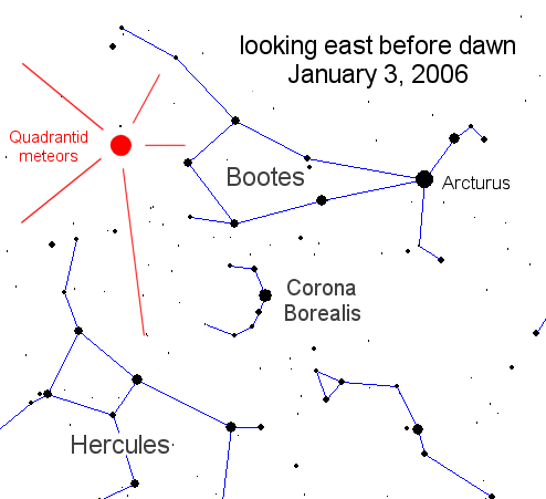
During the end of December and early January, the earth's elliptical orbit takes us directly through the leftover debris of 2003 EH1, producing one of the most spectacular meteor shower displays of the year. This is known as the Quadrantid Meteor Shower.

Just before dawn, the meteors can be seen radiating out of the constellation Bootes in the eastern sky, producing anywhere from 50-120 meteors per minute (quite a high amount). Unfortunately for us, clouds will obstruct the view of this spectacular event--maybe next year...
By Lee Carlaw On Tuesday, January 03, 2006 At 9:37 PM
|

Dank, Dismal, and Dreary

Probably the best words to describe today's weather. Showers arrived about 2-3 hours ahead of schedule (further bolstering the fact that weather forecasting isn't exactly an exact science) associated with a very weak warm frontal boundary that moved north through the region early this morning.


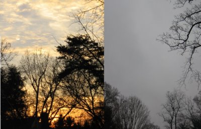
We went from gorgeous afternoon weather yesterday (left) to an abysmal day featuring low clouds like nimbostratus, which is a dark, moisture-laden cloud that is often associated rain or snow, depending on temperature. If you look closely out your window, you may occasionally see ragged-looking clouds beneath the thick nimbostratus known as stratus fractus (or scud cloud in laymans terms).

Showers are now congealing into a large stratiform mass. Rain should become heavier and steadier as we work our way into the nighttime hours, with some heft rainfall likely overnight. Showers will linger through much of the day tomorrow, but the heaviest activity will have departed the region before sunrise.

Wednesday/Thursday...A weak clipper-like low pressure system is expected to develop along the US/Canada border. As with most clipper lows, moisture inflow is minimal as they are, on all sides, more than 600 miles from any large body of water (which releases heat and induces clouds and precipitation). At this point, any precip that falls in association with this system should be rain, except in the far northern/western burbs of western MD and eastern WV. Temperatures may fall just enough to support some snowfall.

Saturday/Sunday...Recent runs of the global European Model (one of the best Mid-range numerical forecast models) reveal the potential for some type of wintry-like event in the Mid Atlantic over the weekend as a low slides up the East Coast. Moisture, and hence, precipitation looks a bit lacking, but temperatures would be cold enough to support snowfall. However, a major caveat in the forecast is the fact this model has very limited support from other numerical models. The GFS forecasts a dry weekend, along with the UKMET. One or two other models hint at this snowfall potential, but still keep precipitation well offshore.

As I like to say...Stay Tuned!
By Lee Carlaw On Monday, January 02, 2006 At 3:40 PM
|

A look back at the year 2005

Temperatures today were able to squeeze into the upper 40s under variable cloudiness associated with several "kinks" in the flow about 25,000 feet aloft.

The forecast over the next 12-48 hours remains basically the same: Clouds will begin to increase out ahead of ahead of a developing low pressure system in the Central Midwest tomorrow morning, and will progressively lower through the atmosphere as the day wears on. The image to the right is a numerical weather forecast valid tomorrow morning. The deep reds are associated with significant vertical motion in the midlevels of the atmosphere, and forecasters can often anticipate clouds and showers in the areas where air is rising rapidly. The "L" in the central Midwest is forecast to move eastward over the Ohio River Valley, and deliver some good rainfall for the region.

You shouldn't have to worry about taking the umbrella out until after the noon hour, before rain showers become heavier and more concentrated. Clouds and showers will stay with us off and on through Tuesday, before our pesky lows move out to sea.

After Tuesday's storm departs, we're stuck in between storms as one low races out to sea, and another forms along US/Canada boarder. By the end of the week, some models hint at a coastal low developing as a primary low transfers some energy across the Appalachian Mountains. Most of this event would likely be rain, but enough cold air may get pulled down from Canada to change precipitation over to snow, especially north and west of the major cities.

Top 5 Weather Events of 2005:
**Note** The following weather events are entirely opinionated, and you may have a different take on the top 5 list.

5. January 22, 2005
A winter storm affects the metropolitan regions of the Mid Atlantic with anywhere from 2 to 4 inches of snow. Schools are canceled, and traffic becomes hazardous. For the remainder of January, temperatures remained relatively uniform in the mid 30s.

4. February 28, 2005
Yet another winter storm throws the District into chaos (well, almost) as 3-6 inches of snow coat the roadways and sidewalks. A total of 5 inches of snow fell during the month of February.

3. July 27, 2005
Nearly 200 reports of wind damage riddled the Storm Prediction Center's database as an intense summer cold front ripped through the east coast. Hundred of trees were toppled under 50-70 mph wind gusts from severe thunderstorms. Laytonsville, MD also reported golfball size hail...nearly 2 inches in diameter.

2. September 24, 2005
The eye of Hurricane Rita made landfall near the Texas/Louisiana Boarder around midnight with biting winds topping 120 mph. Damage was less than expected in the Galveston area, as a slight jog to the east prior to landfall moved the highest winds about 50-100 miles towards eastern Texas.

1. August 29, 2005
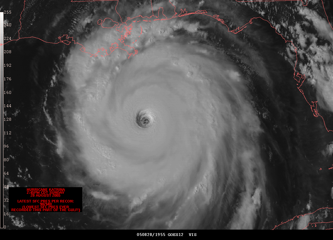
Hurricane Katrina makes landfall in the Southern Plaquemines Parish of Louisiana with 135 mph winds, and gusts topping 145 mph. The levees that kept the below sea-level city from flooding held for the first 12-24 hours after landfall, but failed once water backed up enough along the 17th street canal. Damage estimates are nearing $100 billion, making Katrina the costliest natural disaster in American history.
By Lee Carlaw On Sunday, January 01, 2006 At 3:40 PM
Contact Us
wxdude1990 (at) yahoo.com jyarsh381 (at) hotmail.com

Donations


Useful NOAA Weather Links
Local Weather Service Office
Hydrometeorological Prediction Center
Storm Prediction Center (Severe Weather)
National Hurricane Center

Watches, Warnings, Advisories
Warnings

Numerical Weather Models
NCEP Models (good selection)
PSU E-Wall
25 km WRF model (Hi-Res)
Earl Barker's Model Page
Ensemble MOS data (Washington, DC)

Radar and Satellite
Local Radar

PSU E-Wall Satellite
Local NWS radar
ABC Radar
FOX Radar
NBC Radar

Other Weather Blogs
Capitalweather.com
USA Today's The Weather Guys
The Weather Underground blog
Foot's Forecast
Weather Talk Radio
Eastern US Weather Forum
Phillyweather.net

Other Blogs
BayArea Kicks

Enter your e-mail to subscribe:


Personal Blogs - Blog Top Sites

Subscribe

Personal blogs
Top Blogs

Creative Commons License
This work is licensed under a Creative Commons Attribution 3.0 License.

Archives