
The Next Few Days:
Current indications suggest an anomalously warm airmass will move into the region this week, setting the stage for maximum temperature readings in excess of 10-20 degrees above normal!
I had to do a double-take looking at the weather models this evening when I saw forecast maximum temperatures peaking at 60 degrees tomorrow afternoon. A massive high pressure system off the East Coast will turn the winds around to the southwest, drawing in some of the record-breaking warmth in the Midwest. Expect variable cloudiness tomorrow with some clearing during the late afternoon as high temperatures peak in the upper 50s/lower 60s (that's about +15 above normal).
A weak cold front should traverse the region overnight Monday, shifting the southwesterly winds around to the northwest.
Tuesday: Some upper level moisture looks like it will make its ways into the Mid Atlantic on stiff westerly winds, inducing mostly cloudy conditions, and keeping high temperatures generally shy of 50 degrees.
Overnight Tuesday, a warm frontal boundary associated with a developing low in the Ohio River Valley will attempt to push north of the region. Some widely scattered showers may break out across the region after 3 or 4 in the morning.
Wednesday: Given our proximity to a rather large swath of moisture making its way northward from the Gulf of Mexico, it seems prudent to warrant at least a chance of showers through the day under cloudy skies. High temperatures will hover in the mid to upper 50s.
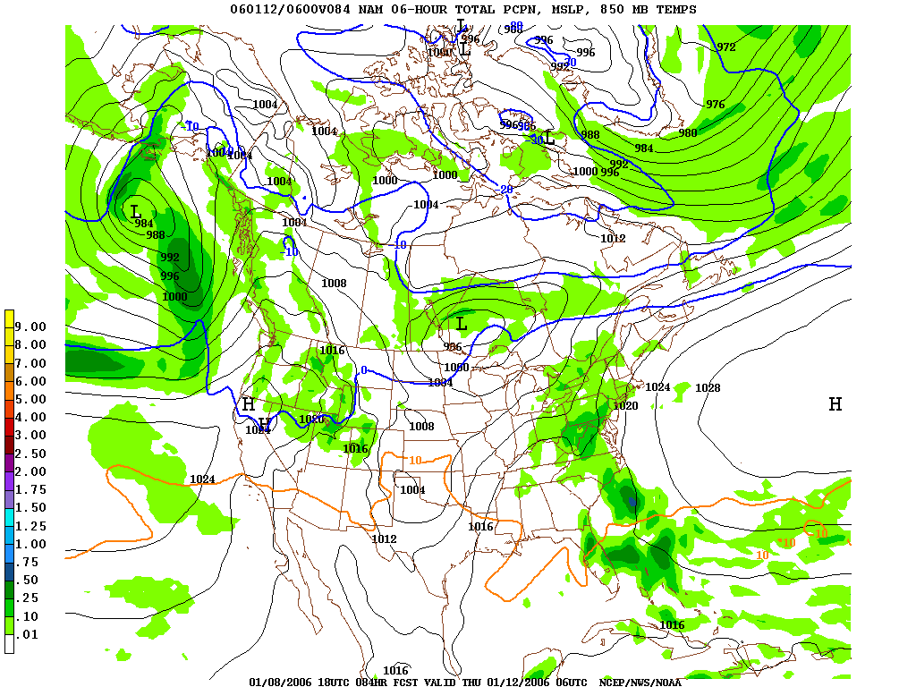 Thursday: There is a little model disparity during this timeframe. A few models suggest the moisture associated with the said low "hops" over the Appalachian Mountains, effectively bypassing the metropolitan region, and leaving us with partly sunny conditions. A few other models, on the other hand, suggest precip lingers around the Mid Atlantic even through Friday.
At this point, I don't feel safe going with a completely dry forecast Thursday. I expect some showers to mingle with the region during the early morning hours, before gradual clearing takes place during the afternoon. If this forecast pans out, high temperatures will likely soar into the upper 50s/near 60 once again.
Channel 4 Launches New Weather site:
Thanks to dcrtv.com for pointing this out. Channel 4 (NBC) recently released its "beta" version of their so-called Weather Plus webpage. You can gather a host of neat information and graphics from this new site, like local forecasts, local doppler radars, cloud/precip forecasts, and localized weather conditions.


for this post
Leave a Reply