Weather over the next several days:
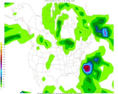
Clear skies dominate over the Mid Atlantic as a ridge of high pressure builds into the region from the northwest. Clouds will, however, begin to increase out of the southwest shortly as a developing storm system slides eastward from the Central Midwest.
Temperatures: The increased cloud cover on Sunday should hold high temperatures in the low to mid 80s, which is at or slightly below average for this time of year.
Precipitation: The chance for a few showers/thundershowers will slowly increase after 7 or 8 PM Sunday evening. It appears, however, that the majority of the rainfall from this system will stay north of the Mason-Dixon line until Monday night. A few numerical weather models depict the possibility of severe thunderstorms moving into the region Tuesday morning and early afternoon. Needless to say, from Monday through Wednesday, scattered to numerous showers and thunderstorms will plague the region, but should significantly cut into the areas rainfall deficit.
Gulf Coast be Warned! Catastrophic hurricane is on the way:
Scalding hot sea surface temperatures, low wind shear, and slow steering currents are all coming together, (or rather, have come together) to form the most intense tropical cyclone this year. Hurricane Dean is currently an upper Category 4 Hurricane with maximum sustained winds of 150 mph near his eye.
This tropical monster has already ravaged portions of the Lesser Antilles, and is headed towards the island of Jamaica as a potential Category 5, which would completely devastate the mountainous region. According to Associated Press, NASA has shortened its spacewalk by one day, and will bring the astronauts back on Tuesday to avoid any potentially dangerous ramifications.
Folks anywhere from New Orleans to Tampico in east central Mexico need to prepare for this dangerous storm. While computer models seem to have converged on a general solution for landfall (around Brownsville, Texas plus or minus 150 miles) climatology points towards Dean turning northeast once he enters the Gulf of Mexico--towards Louisiana and New Orleans (CLP-5 model is the National Hurricane Center's climatology model).
This is an extremely powerful and dangerous tropical system. Jamaica will likely suffer from a direct hit from Hurricane Dean's extreme winds, surge, and rainfall. I expect catastrophic damage on the island in 36 to 48 hours.
Days | Mon | Tue | Wed | Thu | Fri | Sat | Sun |
---|---|---|---|---|---|---|---|
Lee C. | -- | -- | -- | -- | -- | -- | -- |
John Y. | -- | -- | -- | -- | -- | -- | -- |
Days | Mon | Tue | Wed | Thu | Fri | Sat | Sun |
---|---|---|---|---|---|---|---|
Temps | -- | -- | -- | -- | -- | -- | -- |
|
Rain on the Way for DC, Dean to ravage Jamaica
By Lee Carlaw On Saturday, August 18, 2007 At 2:54 PM
|
Time to focus on Dean
Hurricane Dean continued to strengthen Thursday and it appears now that the computer models are beginning to hone in on the future track of the powerful storm.
Dean should cross the Windward Islands and Lesser Antilles Friday as a stong Category 2 storm, with winds between 100-110 mph. Some of the resort islands like Martinique may suffer substantial damage as the hurricane whips across the island chain.
After the islands, Dean should continue on a west-west/northwest track to just south of Jamaica Sunday with sustained winds of 120 mph or more. Next in line will be the Yucatan peninsula on Tuesday, with the storm possibly making landfall as a category 4 storm near Cozumel, Mexico.
After a short ride over the Yucatan, Dean should re-emerge in the Gulf of Mexico and continue re-organize itself before making a final landfall somewhere in the Gulf Coast, most likely Southern Texas.
Personally, I am not convinced that the computer models are doing to well dealing with Dean's rapid speed (on Thursday night it was traveling west at 25 mph), and the progression of the upper-level ridge in the northern Atlantic. As such, I think that Dean may head a little further north than indicated, and anyone west of the Alabama coast are game. None the less, it appears likely that a strong hurricane will potentially impact the Gulf Coast next Thursday or so.
Model spread for Dean
By John Y. On Thursday, August 16, 2007 At 9:59 PM
|
Severe weather outbreak Thursday... still watching tropics
Severe Storms
A strong front will pass through the area late tonight and spark off some major thunderstorms. EHI values (a measure of the tornadic potential across the area) are expected to be tremendous this afternoon. I would expect a number of lines of thunderstorms with damaging winds, and a couple of isolated tornados this afternoon/evening. The deciding factor in whether or not we will see a major outbreak depends on how much sunlight we see during the day. Sunshine, of course leads to destabilization and enables thunderstorms to reach severe limits. Make sure to check watches/warnings as the day progresses.
Notice the very high EHI values on the top-right map. Isolated tornados are possible this afternoon/evening.
-------------------------------------------
Tropics:
Erin: Tropical storm Erin will make landfall in southern Texas today with winds of 40-50 mph. The major damage out of Texas will be flooding however.
Dean: Tropical Storm Dean is very close to reaching hurricane status. I would expect the storm to reach hurricane status later today. Recent computer guidence suggests that the storm will travel into the Gulf of Mexico. More to come...
By John Y. On Wednesday, August 15, 2007 At 10:49 PM
|
Dean, Flossie, TD 5; Its going to be a long week....
As announced several days ago here on DCweather, all of the computer models were indicating that the tropics were going to explode this week. They did not lie. We currently have 3 tropical systems, 2 in the atlantic, and one in particular to watch.
TD 5: At 11:00pm Tuesday night, the NHC announced that the tropical wave in the Gulf of Mexico had gotten itself together well enough to be considered a tropical depression. While this is not good news for southern Texas, if I could be selfish for a minute, it is great news for us. Recent computer runs are indicating that most of the moisture from TD 5 will get absorbed into a front that will give us a chance for substantial rain next week! Unfortunatly, TD 5 may drop 10+ inches of rain on southern Texas; an area that does not need another drop. Additionally, I believe that TD 5 will become Tropical Storm Erica before it makes landfall, and may cause some wind damage on the south Texas coast. Anybody from Galvalston to Corpus Christy should be on alert for updates.
Flossie: Hurricane Flossie weakened Sunday as it moved over much cooler waters near Hawaii. None the less, Flossie is still a strong category 2 hurricane, and will give Hawaii a glancing blow of tropical storm force winds and several inches of rain Wednesday. I do think that the islands should get by without too much in the way of damage.Surfs up: Flossie will cause minimal damage as it travels just south of the Hawaiian Islands Wednesday. Meanwhile, surfers across the state are getting ready for some of the best waves of the year!
TD 5: At 11:00pm Tuesday night, the NHC announced that the tropical wave in the Gulf of Mexico had gotten itself together well enough to be considered a tropical depression. While this is not good news for southern Texas, if I could be selfish for a minute, it is great news for us. Recent computer runs are indicating that most of the moisture from TD 5 will get absorbed into a front that will give us a chance for substantial rain next week! Unfortunatly, TD 5 may drop 10+ inches of rain on southern Texas; an area that does not need another drop. Additionally, I believe that TD 5 will become Tropical Storm Erica before it makes landfall, and may cause some wind damage on the south Texas coast. Anybody from Galvalston to Corpus Christy should be on alert for updates.
TD 5 visible at the bottom of the image. Soon-to-be Erin will make a Texas landfall Thursday
Dean: Tropical Storm Dean had a rough Tuesday. Stronger than expected sheer infultrated the storm on the northeast end and made it dificult for development. None the less, the system is heading into a more favorable environment for development, and should reach hurricane status by Friday. Computer models shifted a bit further south today with regard to the track of Dean, but a NC landfall is not out of the question. If I were forced to make a bet, I would say that Florida would be the target of this storm, but again, the only thing we do know is that the storm will not be a 'fish-spinner' (a storm that hooks out to sea before reaching land) due to a ridge in the northern Atlantic.Despite looking ragged on satellite, the center of Dean remained defined Tuesday, and further development is expected.
By John Y. On Tuesday, August 14, 2007 At 9:11 PM
|
Invest 90 L strengthening in Atlantic...
The tropical wave, Invest 90 L is likely going to upgraded to tropical depression status Monday. The system has strengthened significantly late Sunday, and now has an easily identified center of circulation. This system is still more than a week away from being something to seriously worry about, but none the less, still certainly worth watching.
Computer models suggest that Invest 90 L will strengthen as it heads due west over the next several days. After that--- who knows? The GFS has trended furthur south; to a landfall in southern Texas, but these models are wildly inaccurate for storms 10+ days away.
Rain anybody?
Some badly needed rain is in the forecast for later this week. Meanwhile, a couple of isolated storms are possible Monday, as a weak cold front approaches the area. Nothing severe is anticipated nor is any significant rainfall expected.
Later this week, a more vigorous cold front will give us our first taste of the fall. More importantly however, it will enable a number of systems to ride up along the boundary left by the front during the Friday-Sunday time frame and potentially give us some much needed rain.
By John Y. On Monday, August 13, 2007 At 12:50 AM
|
A few storms for Friday, tropics to explode next week...
Friday will feature a couple of storms across the area. It does not look like any of these storms will reach severe limits because of a left-over storm complex from last night that is currently just off the Mid-atlantic coast. This storm complex will rob the area of the energy necessary for thunderstorm development.
Additionally, clouds have moved into the area in the last hour or so, and the spotty cloudcover will make it dificult for enough heating to go on for thunderstorms. That said, a couple of storms may reach severe limits this afternoon, so stay tuned.
-----------
Now, to move important things--- the computer models (particularly the GFS) have been consistantly showing a tremendous CAT 4-5 Hurricane moving up the East Coast late next week. Now, an important question must be asked: hype, or time to worry?
Well obviously there is no definate answer, but at least last year, the GFS frequesntly showed hurricanes beyond 10 days into the future only to take them off in subsequent runs. What worries me is that this hurricane has been on the maps for all of the last 11 runs, spanning 3 days. Additionally, the UKMET and Euro both now show this 'super hurricane'.
We will need to watch computer model trends closely in the next several days, but the most important thing to note here is that multiple sources seem to be indicating that the tropics are finally going to get going next week. Remember, the NWS still thinks we will be well above average in hurricane #s this year despite the slowish start.
A scary sight: many computer models are indicating that a large hurricane will impact the United States around the 20th of the month.
By John Y. On Friday, August 10, 2007 At 12:06 PM
|
Major severe weather outbreak this afternoon/evening...
4:00 UPDATE: One down, one to go. The first line of storms weakened as they moved into the immediate metro area, however significant damage was felt in northern Maryland. Although the watch box expired recently, another one will be issued shortly. This next batch of storms is heading out of SW PA at the current time and should be in the immediate metro area by 7pm or so. Stay tuned.
11:30 UPDATE: SEVERE THUNDERSTORM WARNINGS ARE IN EFFECT FOR FREDERICK, WASHINGTON, AND CARROL COUNTIES IN MARYLAND. There will be significant wind damage associated with this line of storms as they move across Northern Maryland in the next hour.
10:20 UPDATE: As soon as I finished writing the entry, a watch WAS issued for the area until 4pm. I will be doing updates as this dangerous line of storms moves into the area.
These are the projected times of arrival:
Hagerstown: 11:30am
Frederick: 12:00
Leesburg: 12:15pm
Rockville: 12:30pm
Silver Spring: 1:00pm
Bethesda: 1:00pm
Washington DC: 1:15pm
The NWS has extended the slight risk area for severe storms today to completely encompass the entire DC metro area. A moderate risk has also been discussed for parts of the area. Dangerous winds appear to be the biggest threat, however a tornado is not impossible.
Discussion: A dangerous line of severe storms is progressing through southwestern PA this morning. As this line continues to move east and southeast, it will head into increasingly unstable air (dewpoints are well into the 70s (!) and MLCAPE values on the order of 2500-3000 J/KG), this line will likely strengthen on its southern end as it moves into the region.
I am surprised a watch has not been issued with this line, as there have already been a number of damaging wind reports from interior PA this morning.
After this line goes through, there may be additional storms through the 10pm hour (the line should be out of the area by 5pm or so). Make sure to check radar befor heading out this afternoon... this line is cruising at a clip of 40-50 mph!
Additionally, the NWS issued a slight risk for severe storms tomorrow.... this will be a busy couple of days.
11:30 UPDATE: SEVERE THUNDERSTORM WARNINGS ARE IN EFFECT FOR FREDERICK, WASHINGTON, AND CARROL COUNTIES IN MARYLAND. There will be significant wind damage associated with this line of storms as they move across Northern Maryland in the next hour.
10:20 UPDATE: As soon as I finished writing the entry, a watch WAS issued for the area until 4pm. I will be doing updates as this dangerous line of storms moves into the area.
These are the projected times of arrival:
Hagerstown: 11:30am
Frederick: 12:00
Leesburg: 12:15pm
Rockville: 12:30pm
Silver Spring: 1:00pm
Bethesda: 1:00pm
Washington DC: 1:15pm
The NWS has extended the slight risk area for severe storms today to completely encompass the entire DC metro area. A moderate risk has also been discussed for parts of the area. Dangerous winds appear to be the biggest threat, however a tornado is not impossible.
Discussion: A dangerous line of severe storms is progressing through southwestern PA this morning. As this line continues to move east and southeast, it will head into increasingly unstable air (dewpoints are well into the 70s (!) and MLCAPE values on the order of 2500-3000 J/KG), this line will likely strengthen on its southern end as it moves into the region.
I am surprised a watch has not been issued with this line, as there have already been a number of damaging wind reports from interior PA this morning.
After this line goes through, there may be additional storms through the 10pm hour (the line should be out of the area by 5pm or so). Make sure to check radar befor heading out this afternoon... this line is cruising at a clip of 40-50 mph!
A dangerous line of storms will move into the area by the noon-2pm hour.
Additionally, the NWS issued a slight risk for severe storms tomorrow.... this will be a busy couple of days.
By John Y. On Thursday, August 09, 2007 At 8:49 AM
|
Storms stay west tonight... Major storms on tap for tomorrow, Friday
SEVERE THUNDERSTORM WATCH IS IN EFFECT NORTH AND WEST OF DC FROM WASHINGTON COUNTY, MARYLAND TO HARDY COUNTY, WV WESTWARD UNTIL 10:00PM EST
Discussion: A line of storms that dropped golf-ball size hail in extreme southwestern PA is decending southeasterly at the current time. Unfortunatly, it does not look like the immediate metro area will see anything in the form of rain; the atmosphere is surprising stable this afternoon in spite of the relentless heat/humidity).
The best bet for rain tonight, as mentioned earlier is west towards I-81.
Chances for a shower/storm tonight:
Baltimore: 0%
Frederick: 10%
Washington DC: 20%
Winchester: 50%
Fairfax: 30%
Fredericksburg: 20%
Radar at 3:40 showing the line of storms in the panhandle of Maryland
After reaching 100 degrees in many areas today, relief is finally on the way in the form of severe thunderstorms associated with a boundary that will slip south of the area Friday. More on the severe storms for Thursday tomorrow...
By John Y. On Wednesday, August 08, 2007 At 2:27 PM
|
Highest temperatures so far this year on the way, thunderstorms to follow
Temperatures reached 90 degrees yesterday at the Nation's Capital, but with dewpoint temperatures in the low to mid 70s, the 90 degree heat became an oppressive 94 or 95 degree oven. Today, high temperatures will once again touch, if not eclipse, the 90 degree mark. High moisture levels will create heat index values in the mid to upper 90s. A few showers and strong to severe thunderstorms are possible later today as a weak upper level disturbance passes through the region.
The high temperatures and elevated dewpoints will contribute to large levels of instability this afternoon (see image at right). Convective Available Potential Energy (CAPE) is a measure of the relative amount of instability present in the atmosphere and is a good indication of the likelihood of severe weather. Values at or above 2000 Joules per kilogram are normally sufficient to sustain severe storms. The NAM model depicts CAPE values at or above 3000 J/kg later this afternoon. So, any storms that manage to develop today will have the potential to become severe. Working against the potential for severe storms are a lack of upper level wind shear, relatively little forcing to initiate convection, and dry mid-level air.
The Rest of the Week:
The main story for the rest of the week remains the heat. Temperatures are forecast to hit 97 or 98 degrees tomorrow and Wednesday. Heat Index values will soar into the triple digits due to high humidity and atmospheric moisture content.
A chance of thunderstorms will develop during the afternoon hours through the rest of the work-week, but the best chance of thunderstorms looks to come on Wednesday as a cold front sweeps through the area--probability of precip on Wednesday: 70%.
By Lee Carlaw On Monday, August 06, 2007 At 10:44 AM
|
Severe Storms possible Sunday; Blistering Heat for the Workweek
A couple of severe storms are possible Sunday as a subtle shortwave trough moves into the Central Appalacians. As it does so, a nearly stationary front will sit across the area and spark a round of severe storms. Air soundings for Sunday afternoon show a very steep low-level lapse rate and dew points well into the 60s.
What worries me is the perpendicular nature of the sheer in the atmosphere tomorrow--- that is, at the low-levels in the atmosphere, air will be flowing northeastward, while at the upper levels, air will be traveling southeastward. This perpendicualr nature of sheer allows thunderstorms to rotate, and produce hail and tornados. While a widespread severe weather event is not likely, if enough sun is able to destablize the atmosphere in the morning and early afternoon, a couple of storms may warrant warnings.
If storms do get going, 4-9pm would be time periodto watch... good news for folks heading out to watch the Nats try to win 6 straight at 1:35.
Another important issue is the heat--- temperatures will climb well into the 90s, and may even touch 100 on Wednesday. Heat advisories will likely be issued.
What worries me is the perpendicular nature of the sheer in the atmosphere tomorrow--- that is, at the low-levels in the atmosphere, air will be flowing northeastward, while at the upper levels, air will be traveling southeastward. This perpendicualr nature of sheer allows thunderstorms to rotate, and produce hail and tornados. While a widespread severe weather event is not likely, if enough sun is able to destablize the atmosphere in the morning and early afternoon, a couple of storms may warrant warnings.
If storms do get going, 4-9pm would be time periodto watch... good news for folks heading out to watch the Nats try to win 6 straight at 1:35.
A very strong stationary front will sit over the region Sunday. Notice that lifted indexes are expected to be around -5 over the region tomorrow--- an important igrediant in severe weather.
Another important issue is the heat--- temperatures will climb well into the 90s, and may even touch 100 on Wednesday. Heat advisories will likely be issued.
By John Y. On Saturday, August 04, 2007 At 8:06 PM