Additionally, clouds have moved into the area in the last hour or so, and the spotty cloudcover will make it dificult for enough heating to go on for thunderstorms. That said, a couple of storms may reach severe limits this afternoon, so stay tuned.
-----------
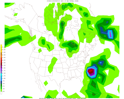
Now, to move important things--- the computer models (particularly the GFS) have been consistantly showing a tremendous CAT 4-5 Hurricane moving up the East Coast late next week. Now, an important question must be asked: hype, or time to worry?
Well obviously there is no definate answer, but at least last year, the GFS frequesntly showed hurricanes beyond 10 days into the future only to take them off in subsequent runs. What worries me is that this hurricane has been on the maps for all of the last 11 runs, spanning 3 days. Additionally, the UKMET and Euro both now show this 'super hurricane'.
We will need to watch computer model trends closely in the next several days, but the most important thing to note here is that multiple sources seem to be indicating that the tropics are finally going to get going next week. Remember, the NWS still thinks we will be well above average in hurricane #s this year despite the slowish start.

A scary sight: many computer models are indicating that a large hurricane will impact the United States around the 20th of the month.


for this post
Leave a Reply