Radar image at 2:15 showing a couple of isolated storms around the area, but nothing severe. The best chance for seeing an isolated strong storm tonight will be east of the city.
---------------------------------------------------------------
This afternoon--- a weak shortwave associated with the residue from yesterday's storms over the upper Plains states (Iowa in particular) with pass through the area later this afternoon and kick off some thunderstorms in the process.
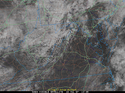
The one feature that the NWS indicated might reduce the risk of severe storms over the area is the lack of daytime heating. However, a look at the morning satelite (below) indicates that most of the area, with the exception I-495 remain cloudless at the current time.
Expect a number of storng storms capable of damaging winds or even an isolated tornado (EHI values and sheer are both respectable for the chance of a weak tornado). I would expect the NWS to issue a Severe Thunderstorm watch at around 2-3pm...

A look at the Satellite image at 10:45 AM today reveals that most of the area is undergoing modest daytime heating--- an important ingrediant for severe storms.


for this post
Leave a Reply