 Tonight and Tomorrow:
It's currently 86 degrees at Washington Reagan National Airport and mostly cloudy to cloudy skies dominate the region. Expect temperatures to only fall another 10 or 12 degrees by early tomorrow morning.
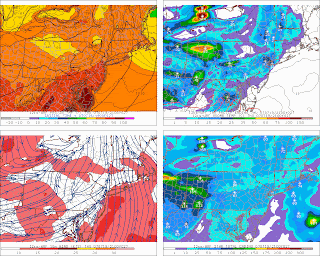
We may start of with sunshine tomorrow, but clouds should gradually increase as a strong upper level impulse approaches the region from the west. Mid afternoon temperatures will likely rocket into the lower 90s before showers and thunderstorms begin breaking out across the region. The Storm Prediction Center currently has the Mid Atlantic outlined under a slight risk of severe thunderstorms for tomorrow afternoon and evening. I think a few strong to intense thunderstorms will develop around the metropolitan region, but most should remain under severe limits (hail greater than 3/4" and/or wind gusts 58 mph).
Image at right: Showers and thunderstorms developing throughout the Mid Atlantic and Northeast as temperatures soar into the upper 80s and lower 90s.
Image courtesy of the PSU Meteorology Website
Extended:
Showers and scattered thunderstorms will likely persist into the nighttime hours Thursday before clearing out of the region by Friday morning. Temperatures during the afternoon will return to near-normal levels (in the mid to upper 80s), and fall into the lower 80s for the weekend.
 The British Open:
The 136th British Open Championship starts tomorrow, Thursday, at famed Carnoustie golf links in Carnoustie, Scotland. Showers are in the forecast for first round play, before clearing up for the second round on Friday.


for this post
Leave a Reply