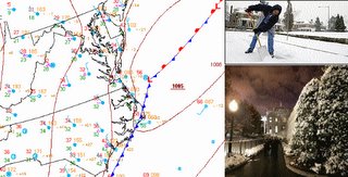
Skies were clear to partly cloudy today across the Mid Atlantic in the wake of last nights winter storm, which continues to pull rapidly northeast into the Canadian Maratimes. High temperatures averaged in the upper 30s.
Tonight, temperatures will once again dip into the lower 20s under mainly clear skies and dying winds. Add an extra layer as you head out of the house tomorrow morning, and use a bit of caution on the roadways as any snow that melted during the day will refreeze by sunrise.
Tomorrow is basically just a carbon copy of today, although temperatures will manage to surge into the upper 30s to near 40, instead of the mid 30s experienced today.
December 4-5 Winter Storm Recap:

While many asked me today "What happened to all the snow you forecasted?" the snowfall forecasts issued by many meteorologists and hobbyists around the region weren't too far off the beaten track. A general swath of 3-4 inches of snow accumulated within my forecast 3-6 inch swath from eastern WV to eastern PA. This forecast was, however, too high for areas of western MD and most of eastern WV as most locations in the said regions received less than 3 inches of snowfall.
I was also quite pleased with the forecast swath of 6-10 inches made for central VA and south central MD around St. Mary's and Calvert counties. Although a bit on the high side (okay, not a single city has reported >6 inches of snowfall), I was able to pin down the area of highest snowfall totals a good 36 hours in advance of this system.
But most disturbing to me is the fact that most people expected snowfall forecasts for roadways--and I can see why this is--because this obviously has the most impact on individuals. Observations are generally taken on a snow board, which is coated white to reflect most oncoming solar radiation, hence begins to "record" snowfall accumulation right at the start of winter storms.
Forecast Grade: C+
This is mainly because totals could have been scaled down somewhat to around 2-4 inches in the 3-6 inch swath, and 3-5 in my 6-10 inch swath. But overall, I am pleased with the snowfall forecast (which can be viewed at the bottom of the previous post).
And while I'm on this topic, I would like to tip my hat to the folks at the Warning Forecast Office in Sterling, Virginia, who basically nailed this storm system, even though numerical models were of very little use nearing the event. Keep up the good work!
Previous Forecast Calls:
Washington, DC: Forecast: 3" Verify: 2.9"
Baltimore (BWI): Forecast: 5" Verify: 2.8"
St. Mary's: Forecast: 7" Verify: 4-6"
Related Links:
Spotter snowfall reports can be accessed here
Snowfall map from the NWS
Season's First Snowfall (Washington Post)
Another Wintry Blast later this week?
Unlike this past winter event, which featured a lack of numerical model support prior to the onset of precipitation, this latest **potential** Nor'easter has a plethora of guidance support nearly 70 hours before any snow falls from the sky.
The GFS model has been emphatic on develop a large low pressure system off the NC coast Friday morning. The type of Scenario the GFS is painting would lead me to believe a significant snowstorm could be in the works for our region beginning very early Friday morning.
However, as we have seen many times in the past, relying on one computer model is basically forecast suicide, so I turn my attention to the NAM (North American Mesoscale). This model has a tendency to severely overpredict Quantative Precipitation Totals leading up to a winter event, and this is no exception to the rule. This model spits out close to 15 inches of snow for the DC area by Saturday morning, which seems far too high to me at this point. But the synoptics are basically the same as the GFS--large low forming off the NC coast Thursday night, out of the region Friday evening.
With this said, there is still some uncertainty regarding this forecast, although my confidence is decidedly higher than with the previous storm system. The potential exists for significant snow and/or ice accumulations across the Mid Atlantic beginning very early Friday morning, and lasting through much of the day, before tapering to flurries by nightfall. At this time, I am relatively confident in a swath of >5" of snow from DC north and west, with ice accumulations a possibility farther south and east.


for this post
Leave a Reply