
 Make no doubt about it, Hurricane Wilma is the main weather feature of the day. Although weakening as she begins to take on extra-tropical characteristics (developing a cold-core center, and frontal structure), Wilma still packs a punch as a 115 mph Category 3 Hurricane. There has been some confusion as to whether or not Wilma is actually the cause of all this nasty weather. Looking over surface plots/computer models, it appears a separate entity is the culprit behind this raw day in the Nation's Capital.
An upper level low present on radar yesterday has become absorbed by the extreme western flank of Wilma's expanding width. The scenario with this storm system is incredible--up to 7 inches of snow has fallen in the higher elevations of the Appalachian Mountains of western PA, MD, and WV. Flood warnings are out on the east coast for rainfall totals in excess of 5 inches, and high wind warnings are up for the Northeast; as Wilma deepens, winds will crank out of the west in Massachusetts, possibly eclipsing hurricane strength of 75 mph. This, along with heavy rain and cold temperatures will make for an absolutely horrid day in New England.
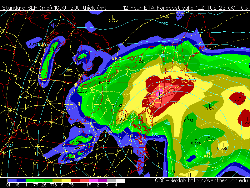
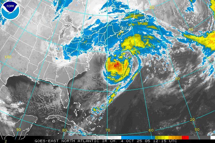 Hurricane Wilma loosing tropical characteristics in the western Atlantic. An upper low over the Appalachians is the culprit behind out nasty weatherWe in the Mid Atlantic have it off a bit better. Winds are only gusting to near 20-30 mph, and the rain showers are comparatively light. The graphic above right reveals the NAM's forecast precipitation from this morning to early this afternoon. Places light Manhattan, Poughkeepsie, NY are in for a drenching, with winds gusting to 50 mph.
So the breakdown for the region goes like this:
Wilma begins to lift out to the northeast into the Grand Banks area this afternoon, taking a lot of the precipitation with it. The upper low hanging out to the west will begin to transfer its energy to a developing coastal low, which will begin to lift out of the region tonight and tomorrow morning. While the chance for showers will decrease markedly overnight tonight/Wednesday AM, at least a chance for showers will hang around through Wednesday until the coastal low zips out towards Nova Scotia. As this happens, winds will decrease into the breezy range:10-25 mph Wednesday evening.


for this post
Leave a Reply