
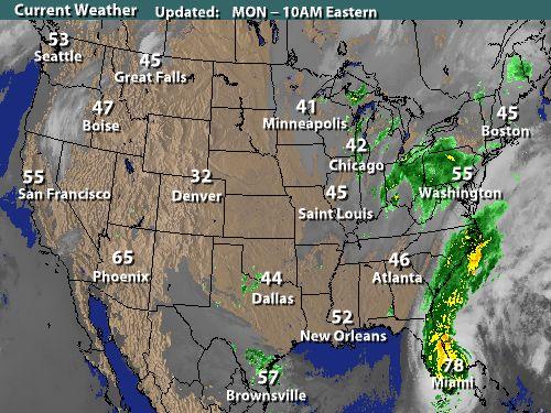
 With Category 2 Hurricane Wilma roaring off the Florida coast later this morning, a set-up for a monster storm scenario will begin to unfold. The remnants of former Tropical storm Alpha have merged with the extensive moisture feed from Wilma, which is moving steadily up the east coast.
A separate low pressure system associated with a Midwestern Trough is spinning around just west of the Appalachian Mountains, spreading scattered showers into the region, especially north and west of the City.
As the day wears on, Wilma will continue to accelerate up the east coast, eventually merging with the said low in the Ohio River Valley. As this occurs, winds will steadily increase out of the west, then the northwest, as Wilma wraps up to a position about 100 miles or so east of the coast.
 With this set-up: Expect rain showers to increase in coverage through the day and tonight. Winds will become gusty out of the northwest as Wilma makes her closest approach to the region. Gusts to 40 or 50 mph are possible with this scenario, along with rainfall totals approaching 2 inches in some locations--mainly east of the District along coastal sections of the Mid Atlantic and Northeast states.
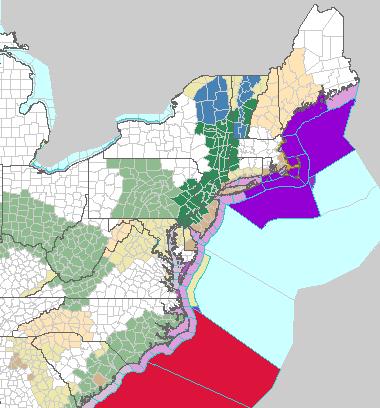
Due to the expected rainfall totals, NWS offices up and down the east coast have issued Flood Watches: from Delaware to New York in response to Wilma. And if you look closely, there is a Winter Storm Watch up for the North Country of New York States Tuesday evening and Wednesday as Wilma draws in cold Canadian air.
Wilma will eventually move out of the picture midweek, as she ushers in cooler air that has been building in southern Canada. It looks like winds will stay up in the 20mph range through Wednesday.


for this post
Leave a Reply