Visible Satellite showing TD-15 getting organized a couple hundred miles east of southern Florida
Latest Visible satellite imagery indicates the system is developing a good amount of convection right around the low level center of circulation with some very cold clous tops (near -75C) embedded around the low pressure.
The graphic below is the National Hurricane Center's 5-day outlook for the eventual track of Td-15. Notice the large bend the storm makes to the east in 3-4 days as a mid-level trough approaches from the west.
5-day Forecast track
There is significant spread in tropical models due to the very weak steering currents throughout the enitre atmosphere with upwards of a 500 mile difference between the Beta and Advection Models (BAM).
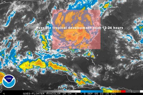
Another area of disturbed weather will have to be watched over the next few days just off the Florida Coast as it meanders very slowly westward. As discussed in last night's post, this system may emerge into the northern Gulf of Mexico during the middle of the week.
IR Satellite image of an area of disturbed weather just east of Florida


for this post
Leave a Reply