
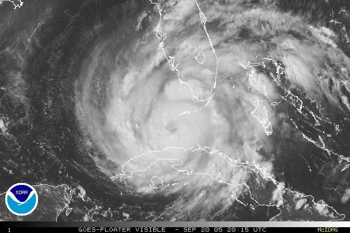
Maximum sustained winds have eclipsed 100mph with gusts approaching 120mph as Rita slowly churns over the warm waters of the eastern Gulf of Mexico, approaching 82-85F. Most of the "colder" waters in the eastern Gulf are associated with upwelling from Hurricane Katrina, who was meandering in this area a little over a week ago. However, when Rita moves west of 87W Longitude, Sea Surface Temperatures will approach 85-90F, when rapid strengthening can be anticipated.

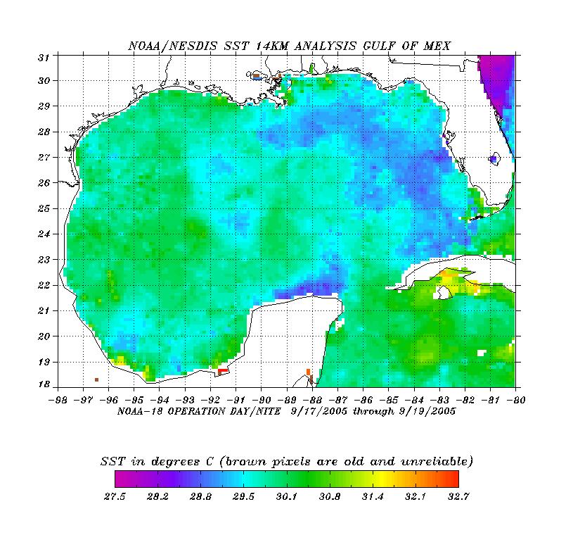
Models seem to be converging along an area from Corpus Christi, to Galveston, TX 4-5 days from now. It now appears Rita will come on shore as a major hurricane with winds in excess of 111mph. And as a side note, a landfall near the New Orleans area appears very unlikely with the largest affects being increased cloudiness and maybe a few rain showers associated with Rita's outer rain bands.
As for the weather in our area, a cold front and pre-frontal trough continue to progress eastward setting off some intense showers and thunderstorms along the eastern shore and lower southern Maryland. The Storms Prediction center has issued a severe thunderstorm watch for portions of eastern Virginia, northern NC, and extreme southern Maryland until 900PM tonight. Although widespread severe weather is not anticipated, isolated severe storms will be possible in the aforementioned areas with small hail (<1" in diameter) and some wind gusts exceeding 60mph.
The front will pass later tonight giving way to mostly sunny conditions comfortable temperatures in the lower 80s before our attention turns to another cold front/trough late in the week with some showers and much cooler conditions, with lows possibly dipping into the 50s and 40s out west this weekend.


for this post
Leave a Reply