
Wednesday gets a little warmer as winds swing around to the south with the approach of a strong cold front. Expect clouds to thicken quickly through the night Wednesday and into Thursday morning. Showers should break out across the western portions of MD/WV overnight Wednesday/Thursday AM and progress eastward with time, reaching the DC area in the early/mid morning hours. At this point, the severe weather threat looks minimal as very little sunshine will be available to add any instability to the atmosphere. Still, a few embedded thunderstorms are possible with the passage of this front.
Low temps Thursday night may even dip into the 40s in the metro region as a strong Canadian High moves into the Mid Atlantic/Northeast. The great conditions last through the weekend with high temperatures Saturday only near 70!
And about that wave in the Caribbean Sea...it's still there and getting organized fairly quickly. Data from the CIMSS (Cooperative Institute for Meteorological Satellite Studies) shows wind shear over the system slackening with a little less than 10kts (about 15mph) of shear affecting the disturbance. On top of this, water temperatures are very high, approaching 90F in isolated areas.
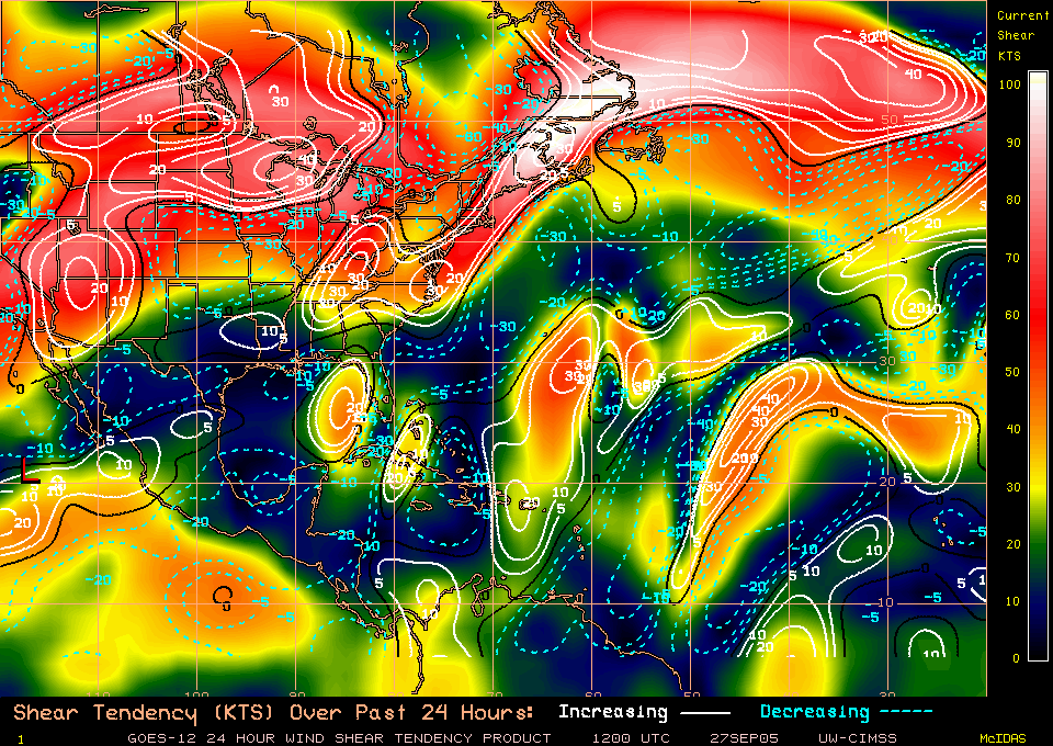
Wind Shear map showing light winds over the central Caribbean
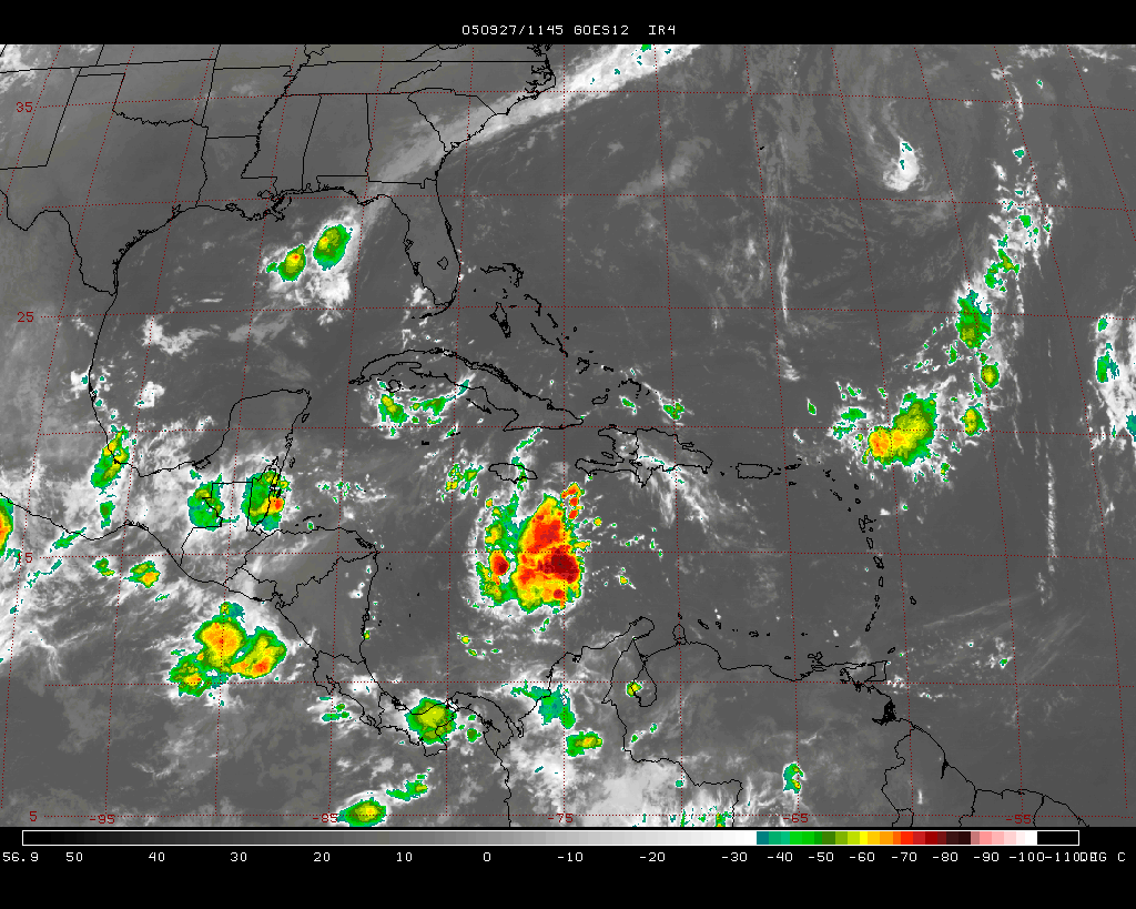
With this said, I expect our next tropical depression to form within 36 hours in the central Caribbean. Models are spread out, with some taking this system into the Gulf of Mexico, and others splitting it off to the northeast. New data in the next few days will help pinpoint where this disturbance heads.


for this post
Leave a Reply