
 Overview:
A storm system that has been plaguing the Midwest for the past few days has finally moved east and has brought low clouds and scattered showers to the region.
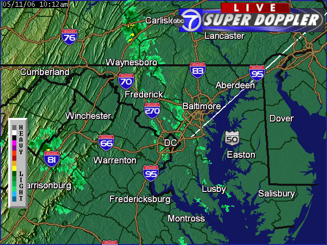
Current radar reveals widely scattered showers stretching from north central Maryland down towards the DC metro region. Overall, expect a dry but dreary Thursday afternoon. If you plan to venture out, take the umbrella just in case.
Right: WJLA radar showing light and widely scattered showers around the DC metro region.
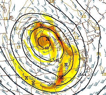
The system that is responsible for this change in weather--from the magnificent sunny afternoons to the boring low overcast--is a cutoff low. This is simply an upper level weather system that gets "stuck" so to speak in the mean wind flow.
Expect the chance for showers to linger through the weekend and into next week. It doesn't look like we'll be getting a break until Wednesday of next week (at the earliest). Just note, it this weekend will not be a washout, just expect a few showers here and there.


